Sightseeing in Koriyama: Waterways, Cherries and Burial Mounds, North to South
Supervised by Suzuking. (KARASU CHANNEL / Occult & horror reporting, 7 years)
Contents
Places to visit in this town (north to south)
Numbers follow the order in the article, from north to south. Select a pin to see its name. Positions are approximate.
- Choshigataki Falls (銚子ヶ滝) One of Japan's 100 Best Waterfalls at the foot of Mount Adatara, named for its resemblance to a sake-pouring choshi flask and also a well-known autumn-leaf spot.
- Sesson-an Hermitage (雪村庵) A hermitage said to be where the Muromachi painter-monk Sesson spent his last years, near the border with Miharu, with old cherry trees and a bamboo-grove path.
- Kaiseizan Park (開成山公園) A roughly 30-hectare city park where the irrigation pond of the Asaka development and about 1,300 cherry trees are constituent properties of Japan Heritage.
- Kaiseizan Daijingu Shrine (開成山大神宮) A shrine founded by Asaka pioneers as a spiritual anchor, and the site where the water-opening ceremony of the Asaka Canal was held.
- Toko-ji Temple and the Nakachi Great Buddha (東光寺と中地大仏) A temple in Konan, south of Lake Inawashiro, whose seated Amida Nyorai about 3 meters high is said to be the largest seated image in Tohoku.
- Hayama Park and the Asaka Canal Hayama Waterfall (麓山公園と安積疏水麓山の飛瀑) A pine-wooded park made to commemorate promotion to a post town, with a waterfall built to celebrate the canal's completion, a Registered Tangible Cultural Property.
- Koriyama City Museum of Art (郡山市立美術館) A museum on a hill in the east, holding British art such as Turner, modern Japanese paintings by Kishida Ryusei and others, and a folding screen by Sesson.
- Daiyasuba Historic Site Park (大安場史跡公園) A group of burial mounds on a hill east of the Abukuma River, where Mound No. 1, about 83 meters long, is a National Historic Site and Tohoku's largest square-front keyhole mound.
- Nunobiki Plateau (布引高原) A plateau about 1,080 meters high south of Lake Inawashiro, where 33 wind turbines stand and Mount Bandai and the lake can be seen.
Show basic information about this town (location, last checked, notes)
- Location
- Koriyama, Fukushima Prefecture, Japan
- Last checked
- 2026.10.05
- Please note
- Opening hours, prices and closing days change often, so we do not list them. Please check each facility's official site before you go.
What Kind of City Is Koriyama?
Koriyama sits in the middle of the Nakadori region of Fukushima Prefecture and is one of the prefecture’s most populous cities. The city stretches widely east to west: to the west it crosses the Ou Mountains to reach the southern shore of Lake Inawashiro, and to the east it touches the Abukuma Highlands. The urban area lies on the flat Asaka Plain, at about 245 meters above sea level. It prospers as a center of commerce, earning the name “the merchant capital,” yet it is an unusual kind of city, neither a castle town nor a port town by origin.
In the Edo period, Koriyama was a post town on the Oshu Kaido, but it lay on a waterless wilderness and is said to have had a population of only about 5,000. The town changed greatly in the Meiji era. The Asaka Canal, which draws water from Lake Inawashiro, was opened, former samurai families settled from all over the country, and the wasteland became farmland. This article introduces sights from north to south, in descending order of latitude. We start with a waterfall at a mountain foot, then move down through a cherry blossom park, burial mounds and, finally, a plateau south of Lake Inawashiro.

A glow-in-the-dark spray paint that stores sunlight or fluorescent light and glows for 4–8 hours in the dark — apply it as a simple marker on a stair rail, breaker panel, or evacuation route inside a ruin to mark a meeting point or exit for your group.
Nippe Home Long-Lasting Glow-in-the-Dark Spray, Green 80ml HUQ004-80
We may earn a referral fee on purchases made through these links.
1. Choshigataki Falls (銚子ヶ滝)
Choshigataki Falls lie at the foot of Mount Adatara, in Ishimuro, Atami-machi, Koriyama, and have been selected as one of Japan’s 100 Best Waterfalls. They are said to be about 48 meters high, and the name is said to come from the way the falling water resembles a choshi, a sake-pouring flask. In autumn the surrounding trees change color, and the falls are known as a place for viewing autumn leaves.
To reach them, you must walk a mountain path after parking. Even by the route through the pasture, it is said to take about 20 to 40 minutes on foot from the trailhead, so this is less a developed tourist spot than a place where you meet the sound of water deep in the mountains. Please check the weather and trail conditions beforehand and go with suitable equipment.
Nearby runs a mountain road known as the Bonari Green Line, with pastures and other attractions scattered along it. The road was once a toll road but has been free since 2006. The waterfall’s water is nurtured by snowmelt and rain on Mount Adatara, making this the spot where you can most closely feel the water cycle that connects mountain and town.
2. Sesson-an Hermitage (雪村庵)
Sesson-an is a small hermitage in Nishida-machi, Koriyama, said to be where Sesson Shukei, a Muromachi-period painter-monk, spent his later years. When the building was first erected is unclear, and the present building was rebuilt in a later age. In 1658, a monk from the family temple of the Akita clan, lords of Miharu, heard from a local elder that this was Sesson’s place of retirement and wrote it on the hermitage’s plaque. He then petitioned the lord to rebuild the ruined hermitage and named it “Obaizan Sesson-an.”
The area was originally called “Sumomoda,” but is said to have been renamed “Sesson” later, so a painter’s name became a place name. In front of the hermitage stand old weeping cherry and plum trees called “Sesson-zakura” and “Sesson-bai,” one of the town’s cherry blossom spots. If you follow the path to the left of the hermitage, you will find in a bamboo grove a large granite stone said to be Sesson’s grave.
In this site’s view, perhaps Sesson chose this quiet village for his later years because he wanted time to face his own brush, away from the glitter of the capital. This is our own speculation, but the sound of wind through the bamboo grove and the changing presence of cherry and plum through the seasons feel like the empty space of an ink painting. Sesson’s paintings are said to be held at the Koriyama City Museum of Art, so visiting both deepens understanding.
3. Kaiseizan Park (開成山公園)
Kaiseizan Park is a roughly 30-hectare general park right beside Koriyama City Hall. It was selected as one of Japan’s 100 Best Historical Parks in 2006. Lake Isuzu in the park is a pond built for irrigation during the Asaka development, and together with about 1,300 cherry trees it was certified in 2016 as a constituent cultural property of a Japan Heritage story.
In the Edo period this area was a hunting ground of the Nihonmatsu domain. In 1873, Kaiseisha, a company funded by Koriyama merchants, cleared the marshes and wetlands of Kaiseizan and opened Kuwano Village. Following this move, the national government began the Asaka development and canal-building, and Lake Isuzu and other ponds were dug to store water. Around 1878 Kaiseisha is said to have planted about 4,000 cherry trees, and among them a Somei-yoshino is said to be the oldest surviving tree.
The cherries were at one time designated a National Natural Monument, but the designation was later lifted because of park improvements and other factors. In spring about 1,300 cherry trees bloom, and the park is crowded as one of the leading cherry-viewing spots in Fukushima Prefecture. In the film “The Girl Who Leapt Through Time” (released in 2010), the embankment near the archery range was used as the location for a scene of an avenue of cherry trees. The park’s greatest charm is that the traces of the pioneers’ hardship have become a landscape where residents now relax.
4. Kaiseizan Daijingu Shrine (開成山大神宮)
Kaiseizan Daijingu is a shrine enshrining a divided spirit of Ise Jingu and is also called “the Ise Shrine of Tohoku.” It was founded in 1876 (Meiji 9), and tradition says it was realized when Nakajo Masatsune, a Fukushima prefectural official, appealed to Ise Jingu to provide a spiritual anchor for the people who came for the Asaka development. The shrine-name tablet on the worship hall is said to be in the calligraphy of Prince Arisugawa Taruhito.
The shrine is closely tied to the history of the Asaka Canal. The groundbreaking ceremony for the canal drawing water from Lake Inawashiro was held here on December 27, 1879, and the water-opening ceremony on October 1, 1882, with important figures including Iwakura Tomomi invited. Within the grounds are a statue of Abe Mohei, the first president of Kaiseisha, and a monument praising Nakajo Masatsune, so the key figures of the development still stand in the precincts.
There is also a spot modeled on the Mitarashi purification place on the Isuzu River at Ise Jingu, a quiet corner where an arched drum bridge crosses a stream. During the spring cherry blossom festival, lanterns are lit and kagura and Kaiseizan taiko are dedicated. Since this is an active shrine, please walk quietly and respect worshippers and festivals. Together with neighboring Kaiseizan Park, it suits a stroll tracing the story of the development.
5. Toko-ji Temple and the Nakachi Great Buddha (東光寺と中地大仏)
Toko-ji is a Shingon-sect temple in Konan-machi, south of Lake Inawashiro, and enshrines a seated Amida Nyorai known as the “Nakachi Great Buddha.” The temple is said to have begun in 1053, when Minamoto no Yoshiie, advancing on Aizu, built a hall in the mountains and installed the image in gratitude for divine and Buddhist protection and to pray for the war dead.
The Nakachi Great Buddha is about 3 meters high, built of joined wood and finished in gold leaf over lacquer, and is said to be the largest wooden seated Amida Nyorai in Tohoku. It is a Fukushima Prefecture Designated Tangible Cultural Property. When a fire broke out, the shoulders were reportedly shaved down to pull the image out of the hall, which is said to be why the shoulders are narrow. In preparation for another fire, the image is said to be set on wooden wheels.
Within the grounds stands the “Daibutsu no Keyaki” zelkova, about 280 centimeters in diameter, designated a Prefectural Natural Monument. During daylight you can see the image through a window, but a prior inquiry is said to be needed for a closer viewing. Since this is an active temple, please pray quietly and respect the local people’s faith.
6. Hayama Park and the Asaka Canal Hayama Waterfall (麓山公園と安積疏水麓山の飛瀑)
Hayama Park is a small pine-wooded park within walking distance of Koriyama Station. It began in 1824 to commemorate Koriyama Village’s promotion to a post town, and in the early Meiji period local volunteers shaped it into its present form, when it was called “Kyorakuen.” Though small, at about 2.2 hectares, it was selected as one of Japan’s 100 Best Historical Parks in 2007.
Scattered through the park are a haiku monument to Matsuo Basho and various other monuments, memorial towers and shrines. Among them, the highlight is the “Hayama Falls,” built to commemorate the completion of the Asaka Canal in 1882. The water-opening ceremony included kabuki and a ball, and it is said to have drawn unprecedented crowds. The falls, once buried, were restored in 1991 and in 2002 became a Registered Tangible Cultural Property of Japan as the “Asaka Canal Hayama Waterfall.” In 2016 they were also certified as a constituent property of Japan Heritage.
Water carried far from Lake Inawashiro falls as a cascade in the middle of the town. How proud that sight must have been for the people of Koriyama, who had never been blessed with water. In this site’s view, the falls are not mere scenery but a monument to the day the town’s long-held wish came true. As you listen to the water, try to imagine the joy of the people of the Meiji era.
7. Koriyama City Museum of Art (郡山市立美術館)
Koriyama City Museum of Art is in Yasuhara-cho, in the east of the city. It collects British art including Turner, modern Japanese art such as Kishida Ryusei, and paintings and sculptures with ties to Koriyama such as the work of Sesson. Special exhibitions, including overseas shows, are held several times a year.
The building was designed by Yanagisawa Takahiko and his team and is a reinforced-concrete structure with one basement floor and two floors above ground. It is also highly regarded as architecture, having received the BCS Prize in 1994 and the Japan Art Academy Prize in fiscal 1995, and it has been chosen among Japan’s 100 Best Public Buildings. Not only the collection but the building itself is a highlight.
That Sesson’s “Landscapes of the Four Seasons” folding screen is exhibited here suggests a link to the nearby Sesson-an. That the brush of the painter-monk who lived in the hermitage now rests in a Koriyama museum is a coincidence that also proves how much the region has valued its culture. Special exhibitions and opening days change, so please check official information before you go.
8. Daiyasuba Historic Site Park (大安場史跡公園)
Daiyasuba Historic Site Park is a park centered on burial mounds in Daizenji, Tamura-machi, Koriyama. It sits on a low hill about 250 meters above sea level on the east bank of the Abukuma River, overlooking the Asaka Basin, and consists of one keyhole-shaped mound with a square front (zenpo-koen-fun) and four round mounds. Mound No. 1 is the largest square-front keyhole mound in the Tohoku region and was designated a National Historic Site on September 6, 2000.
The mounds were discovered in 1991, and subsequent excavation estimated that No. 1 is about 83 meters long and was built in the latter half of the 4th century. Beneath the top of the mound, a large wooden coffin about 9 meters long was found. From inside came a stone bracelet-shaped object, the “ishikushiro,” the first to be reliably excavated in Tohoku, as well as long swords, blades and spears.
While the Aizu region has many keyhole mounds with round backs, this one has a square back. A relationship with the Nasu region of Tochigi Prefecture is suggested, so ties with distant lands appear even in the shape of a tomb. In this site’s view, the 4th-century chieftains of the Nakadori may have exchanged widely along the Abukuma River’s water routes and roads. Cracks caused by the Great East Japan Earthquake were repaired by July 2013.
9. Nunobiki Plateau (布引高原)
Nunobiki Plateau is a tableland in the west of Koriyama, south of Lake Inawashiro, centered on Aizu-Nunobikiyama (1,081 meters above sea level). Its elevation is about 1,080 meters, and because heavy winter snow closes the roads, no one lives there. Farming has been done by commuting from settlements on the shore of Lake Inawashiro.
On the plateau stand 33 wind turbines, which began commercial operation in February 2007. Each turbine is about 100 meters tall, with blades about 30 meters long. The construction of this power plant led the area to be named “Koriyama Nunobiki Wind Plateau.” An observation deck and walking courses have been built, with views over Mount Bandai and Lake Inawashiro.
Since around 2011, many sunflowers have been planted, and from late August to mid-September the plateau has been introduced as a famous spot where a reported 400,000 sunflowers bloom. It is also known for rapeseed flowers and cosmos. There is no public transport to the plateau and the road is closed in winter, so please check the season and road conditions in advance before you go.
Local Specialties: Food and Drink
Among Koriyama’s specialties, the city promotes sweets. Several long-established confectioners representing Fukushima Prefecture have their head shops in the city, offering a wide range of sweets from manju and yubeshi to cream-based Western confections. The local sweet known as “Cream Box” is also one of the city’s specialties.
The city is said to have about 600 ramen shops, and is known as a fiercely competitive district where each shop vies for individuality. In recent years Koriyama green curry has also been promoted as a new specialty. There are many sake breweries, including a brewing company that makes one of Japan’s few local whiskies, and a new-sake festival is held in winter. Offerings differ from shop to shop, so please check the latest information before you go.
Rare Wildlife and Nature
Koriyama’s nature is embraced by Lake Inawashiro, Mount Adatara and the Abukuma River. Lake Inawashiro is Japan’s fourth-largest lake and is also called “Tenkyo-ko” (Heaven’s Mirror Lake) because its surface looks like a mirror. Konan-machi, south of the lake, is a heavy-snow area and is deep in snow in winter. Waterside plants are also highlights, such as the colonies of skunk cabbage at Umairi-shinden and the water buttercup (baikamo) in the Shimizu River.
Among cherry trees, the “Benishidare Jizo-zakura,” said to be about 400 years old, is a municipal Natural Monument. Along the embankment of the Sasahara River, an avenue of about 1,000 cherry trees continues for about 2 kilometers. In spring, cherries in Kaiseizan, Sesson-an and Sasahara River bloom one after another around the city.
Other Notable Things About This City
What cannot be left out in talking about Koriyama’s development is the Asaka Canal, which opened to water in 1882. This channel, which draws water from Lake Inawashiro to the Asaka wilderness, is counted among Japan’s Three Great Canals along with the Nasu Canal and the Lake Biwa Canal. Construction began in 1879, and a channel of about 130 kilometers was completed in only about three years with a total of 850,000 workers. The water was used not only for agriculture but also for hydroelectric power and drinking, and Japan’s first high-voltage power transmission is said to have reached Koriyama. In 2016, the canal’s history was certified as Japan Heritage.
In industry, it is also known as the city where commercial production of lithium-ion batteries began for the first time in the world. Takashiba in the city is said to be the birthplace of Miharu-goma toy horses and Miharu papier-mache dolls, a village of local folk crafts that has continued since the Edo period. A variety of festivals are held through the year, including the Koriyama Unemematsuri in August, and the city also has a face as a “city of music,” valuing music and choral singing.
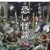
A collection of true ghost stories by Tanishi Matsubara — a reference for our reading-feature and analysis articles.
Scary Ghost Stories (Tanishi Matsubara / Futami Shobo)
We may earn a referral fee on purchases made through these links.
The Night Side: Ghost Stories and Haunted Spots of This City
So far we have walked Koriyama’s daytime face: people who brought a canal to a waterless wilderness, a painter-monk who left the capital, and ancient chieftains who slept in burial mounds. Each place layers the time of people who prayed, worked, and sometimes paid a great sacrifice.
That depth connects to the night side as well. Koriyama has ghost stories and rumors of its own, but many of them have uncertain locations or lie near active temples and shrines and residents’ daily lives, so we do not recommend searching for them. In this site’s view, a ghost story is something like a shadow that a land’s history has cast on people’s minds. The more you learn about the hardships of the development, the deeper your respect for quiet places becomes.
At KARASU CHANNEL, we present true ghost stories and haunted spots not so that you can visit them but so that they are recorded. After getting to know the daytime scenery, please read the night stories too.
Before You Go
Opening hours, fees, closing days and access change easily, so they are not included in this article. Before you go, please check the latest information on the official website of each facility or local government. Some places may be restricted from entry because of weather or disasters.
Frequently Asked Questions
Q. In what order is it efficient to see Koriyama’s sights?
A. This article introduces them from north to south. Grouping by area makes it easier: the Kaiseizan and Hayama area in the city center, the museum and Sesson-an in the east, the foot of Mount Adatara in the north, and Konan and Nunobiki Plateau in the west. Because of the distances, please check your means of travel and seasonal road conditions with the city or the official tourist guide.
Q. What is Koriyama’s specialty food?
A. Sweets such as manju and yubeshi, ramen (said to be about 600 shops in the city), the new specialty green curry, and local whisky and sake are well known. Offerings differ from shop to shop, so please check the latest information before you go.
Q. Is it all right to visit in winter?
A. Konan-machi and Nunobiki Plateau in western Koriyama are heavy-snow areas, and roads may be closed in winter. If you head into the mountains, please check the weather and road information in advance and plan sensibly.
Official sites and references consulted
https://ja.wikipedia.org/wiki/郡山市
https://ja.wikipedia.org/wiki/開成山公園
https://ja.wikipedia.org/wiki/開成山大神宮
https://ja.wikipedia.org/wiki/麓山公園
https://ja.wikipedia.org/wiki/安積疏水
https://ja.wikipedia.org/wiki/郡山市立美術館
https://ja.wikipedia.org/wiki/雪村庵
https://ja.wikipedia.org/wiki/大安場古墳
https://ja.wikipedia.org/wiki/東光寺_(郡山市)
https://ja.wikipedia.org/wiki/銚子ケ滝
https://ja.wikipedia.org/wiki/布引高原

Supervised by Suzuking.
Affiliation: KARASU CHANNEL
Occult & horror reporting: 7 years (since 2020)
Followers: YouTube 5,000+ / X 25,000+
On-site investigations: 30+
Haunted locations near this town
Besides its daytime face, this land has a night side too. Read it as a record if you are curious. Some of these places are not safe or permitted to enter.