Rebun Sights: The Flower Island, North to South
Supervised by Suzuking. (KARASU CHANNEL / Occult & horror reporting, 7 years)
Contents
Places to visit in this town (north to south)
Numbers follow the order in the article, from north to south. Select a pin to see its name. Positions are approximate.
- Cape Sukoton (スコトン岬) A cape at the northern tip of the island. On clear days Karafuto can be seen across the sea, and facilities calling themselves the "northernmost limit" are scattered around.
- Lake Kushu (久種湖) The northernmost lake in the area under Japanese administration. A skunk cabbage colony, with a walking path and campground on its shore.
- Cape Sukai (澄海岬) A cape said to be named for the color of its transparent sea. It lies on the west-coast trekking course and was a filming location for a promotional video.
- Mt. Rebun (礼文岳) The highest mountain on Rebun Island at 490 meters, with views from Karafuto to Rishiri Fuji on clear days.
- Momoiwa Observation Deck (桃岩展望台) An observation deck overlooking Momoiwa, a rock said to have formed from magma about 13 million years ago, with slopes of flowers spreading around it.
- Neko-iwa, the Cat Rock (猫岩) A strange rock jutting into the sea in the shape of a sitting cat, one of the signature scenic spots of the island's southwest alongside Momoiwa and Jizo-iwa.
Show basic information about this town (location, last checked, notes)
- Location
- Rebun, Hokkaido, Japan
- Last checked
- 2026.10.06
- Please note
- Opening hours, prices and closing days change often, so we do not list them. Please check each facility's official site before you go.
What Kind of Town Is Rebun?
Rebun is a town that occupies the whole of Rebun Island, which floats in the Sea of Japan about 60 kilometers west of Wakkanai. Excluding the Northern Territories, it is the northernmost inhabited island in Japan, and the northernmost town as well. The island runs about 25 kilometers north to south and measures about 72 kilometers around, and the cliffs that drop into the sea on its west side cannot be circled by car or motorcycle.
Thanks to the cool climate, more than 300 kinds of alpine plants bloom right down at sea level, and the island is called the “Floating Island of Flowers.” This article introduces the sights of the island in order of latitude, from north to south. We start at the northernmost cape, then move down through a lake, another cape, a mountain, and finally the strange rocks of the southwest.

Haunted-spot exploration often means long hours driving and waiting in the car from late night into early morning, often in mountain or rural areas with no convenience store nearby — a car fridge keeps drinks and snacks fresh for hours. Adjustable from -20°C to 20°C, for either refrigeration or freezing.
IRIS OHYAMA Portable Fridge/Freezer 20L IPD-2A-B (for Vehicle Use)
We may earn a referral fee on purchases made through these links.
1. Cape Sukoton (スコトン岬)
Cape Sukoton is a cape jutting out at the northern end of Rebun Island. Its name comes from the Ainu words “Shikotoni (big valley)” and “Tomari (inlet),” meaning “an inlet in a big valley.” On clear days you can sometimes see Karafuto (Sakhalin) across the sea.
It once claimed the title of “northernmost” together with Cape Soya, but a survey showed that Cape Soya lies about 6.5 kilometers farther north, so Sukoton now calls itself the “northernmost limit.” The cape has a “northernmost-limit toilet,” a “northernmost-limit bus stop” and similar features, which make it a small attraction in itself. Offshore you can see Todo Island (海驢島).
It is also known as the starting point of a long trekking course along the island’s west coast, and you often see hikers here. The wind is strong and the weather changes easily, so please prepare warm clothing and check the forecast. The local bus from the port takes about an hour, so it is reassuring to check the return bus times as well.
2. Lake Kushu (久種湖)
Lake Kushu is a freshwater lake in the north of Rebun Island, lying behind a sand dune that built up along Funadomari Bay. Among lakes with “lake” in their names, it is the northernmost within the area under Japanese administration. Its name is said to come from the Ainu words for “a marsh that crosses over a mountain,” and it lies within Rishiri-Rebun-Sarobetsu National Park.
It is famous as a colony of skunk cabbage, and in spring white flowers decorate the lakeshore. In the lake live fish including carp, said to have been released by pupils of the Funadomari school in the mid-Meiji era, as well as char and pond smelt. It freezes in winter, when swans and ducks visit. In May, pond smelt swim up the rivers that flow in.
On the shore there are a campground and an observation deck, and a walking path circles the lake. To the west of the lake, remains of an Ainu-era fortress (chashi) are also said to be visible. Beside the lake there once stood Japan’s northernmost ranch, which is also known as the setting of the TV drama “Netsuchu Jidai (Sensei-hen).”
3. Cape Sukai (澄海岬)
Cape Sukai is a cape in the northwest of Rebun Island, and its name, written with characters meaning “clear sea,” is read “Sukai.” True to its name, it is known for the beautiful blue-green of its clear water, and it is one of the popular spots on the west-coast trekking course. Because cliffs run along the island’s west side, the view from here lets you feel both the harshness and the beauty of the island at once.
It is also known for appearing in the promotional video for the song “Gin no Ryu no Se ni Notte” by the singer Miyuki Nakajima, a song that became familiar as the ending theme of the drama “Dr. Koto’s Clinic.” The scenery of this cape is shown as a filming location for the video.
The path to the cape runs along a cliff close to the sea and becomes dangerous when the weather turns rough. Please follow the information issued by guides and the local government, and visit with sufficient safety measures. On days of strong wind or fog, it is important not to push yourself.
4. Mt. Rebun (礼文岳)
Mt. Rebun is the highest peak on Rebun Island, at 490 meters above sea level. It has also been chosen as one of the “100 Famous Flower Mountains,” and the trail of about 4.5 kilometers one way changes its scenery from forest to bamboo grass, then creeping pine and scree. The ascent takes about 2 hours and the descent about an hour and a half. The tree line is reached at around 350 meters.
On a clear day, it is said that from the summit you can see Karafuto and Moneron Island beyond Cape Sukoton to the north, and Rishiri Fuji, Teuri Island and Yagishiri Island across the Rebun Strait to the south. Yellow rhododendron and Urup bladderpod once grew in clusters near the summit, but they are said to have died out by around the 1960s because of illegal digging.
Even though the mountain is not high, the weather can change suddenly. There are no toilets, water points or shops along the route, and it is considered best to make preparations in the Naiji settlement at the foot of the mountain. On the trail, do not pick or take away flowers, and walk according to the rules.
5. Momoiwa Observation Deck (桃岩展望台)
The Momoiwa Observation Deck stands on high ground in the southwest of Rebun Island, near Kafuka, and looks out on Momoiwa, a huge rock shaped like a peach. Momoiwa is said to have formed about 13 million years ago when magma hardened on the sea floor. It is also a rock that tells us the island’s strata were formed beneath the sea.
The alpine plant communities around Momoiwa are designated a National Natural Monument. In the southwest of the island, strange rocks such as Jizo-iwa and Neko-iwa stand in a line alongside Momoiwa, and the area is a scenic spot often included in sightseeing bus routes. In flower season the surrounding slopes are colored by alpine plants.
It is said that in 1456 a battle between Ainu groups took place near Momoiwa. It is a place where the island’s history is carved, and behind the flower scenery lie layers of old time. Parts of the walking path run close to the cliff, so please do not leave the path.
6. Neko-iwa, the Cat Rock (猫岩)
Neko-iwa is a strange rock on the coast of southwest Rebun Island, shaped like a sitting cat. Together with Momoiwa and Jizo-iwa, it is known as a scenic spot in the island’s southwest. The fun lies in how a rock carved by waves looks like an animal within the landscape.
From around Jizo-iwa, ammonite fossils more than 110 million years old are said to have been found. The island’s strata include sandstone and mudstone that accumulated on the sea floor in the Cretaceous period. The strange rock before your eyes may be carrying memories of a distant ancient sea.
Waves can run high around the rocks, so please do not get too close to the sea. It is one of the stops on the sightseeing bus route, and also serves as one of the bases when touring the island. When visiting, take care over the weather and the state of the waves.
Local Specialties, Food and Drink
Rebun Island is known as the birthplace of the sea urchin bowl (uni-don). It is an island blessed with the sea’s bounty throughout the year, including summer Ezo bafun sea urchin, kelp and Atka mackerel (hokke). Fishing and tourism are the town’s main industries.
Kelp and sea urchin raised in the cool sea are the pride of the island. Availability and season change easily, and there are restrictions on the sea urchin fishing season too, so please check the latest information before you go.
Rare Creatures and Nature
Rebun Island is the “Floating Island of Flowers,” where about 300 kinds of alpine plants bloom. Many flowers carry the island’s name, such as Rebun atsumorisou (Rebun lady’s slipper), Rebun usuyukisou, Rebunsou and Rebun kozakura. The kinds of flowers change every two to three weeks.
The Rebun lady’s slipper was once seen across the whole island, but its numbers dropped sharply because of illegal digging, and today it is almost never seen outside the colonies in protected areas. Please do not pick or take away flowers, and admire them according to the rules.
The west side of the island has much fog and strong wind, and since that climate lowers the temperature, only flowers adapted to that environment are said to grow. Wild seals live in Funadomari Bay in the north and can sometimes be observed all year round.
Other Notable Things About This Town
The island’s history reaches back to ancient times, as remains of the Okhotsk culture have been found at Kafukai and Funadomari. Artifacts excavated from the Funadomari site are designated Important Cultural Properties. In the Edo period it became part of a Matsumae domain trading post, and in 1846 Yanagiya Mannosuke moved from Aomori and opened a fishing ground.
On May 9, 1948, the center line of an annular solar eclipse passed over Rebun Island, and many astronomers visited the island even though it was shortly after the war. There is a record that a total eclipse was observed for one second. A monument commemorating the observation stands on the island.
The town was established in 1959. There are seasonal events such as the Flower Festival in June, the Itsukushima Shrine Festival in July, and the Lakeside Festival and Strait Festival in August. The island has also been the setting for the film “Kita no Canary-tachi” and various dramas.
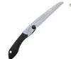
A tool for cutting through overgrown branches and brush at a ruin or mountain spot.
Silky (UM Kogyo) Pocketboy Folding Saw, All-Purpose Blade, No Case, 340-18, 170mm, Outdoor/Pruning/Camping
We may earn a referral fee on purchases made through these links.
The Night Side: Ghost Stories and Haunted Places of This Town
So far we have followed the daytime face of Rebun from north to south: the northernmost cape, the flowering mountain, the coast of strange rocks. Every one of these places carries layers of time lived by people amid rough seas and fog.
As for the night side, we have not been able to identify any story that stands as a ghost tale or haunted spot. In our view, the cliffs of the fog-wrapped west coast have something of the air of a doorway into a story. That is a speculation of ours, and not a fact. Cliffs and capes are especially dangerous at night, so please never go searching for anything after dark.
On Karasu Channel, we set out true ghost stories and haunted places not to visit them but to record them. Having learned the daytime scenery, please read the stories of the night as well.
Before You Go
Opening hours, fees, closing days and access change easily, so they are not listed in this article. Before you go, please check the latest information on the official website of each facility or local government. Some places may be restricted from entry because of weather or disasters.
Frequently Asked Questions
Q. How do I get to Rebun Island?
A. Take the ferry from Wakkanai Port to Kafuka Port. Sailings are sometimes cancelled because of weather, so please check operating conditions beforehand.
Q. When is the best time to see the flowers?
A. From around June through summer, the blooming flowers change every two to three weeks. It varies from year to year, so please check the latest information.
Q. Is Cape Sukoton the northernmost point of Japan?
A. No. A survey showed that Cape Soya lies farther north. Cape Sukoton is called the “northernmost limit.”
Official sites and references consulted
https://ja.wikipedia.org/wiki/礼文町
https://ja.wikipedia.org/wiki/礼文島
https://ja.wikipedia.org/wiki/スコトン岬
https://ja.wikipedia.org/wiki/久種湖
https://ja.wikipedia.org/wiki/礼文岳

Supervised by Suzuking.
Affiliation: KARASU CHANNEL
Occult & horror reporting: 7 years (since 2020)
Followers: YouTube 5,000+ / X 25,000+
On-site investigations: 30+