Shimokawa Sights: Two Mines and a Stone Great Wall
Supervised by Suzuking. (KARASU CHANNEL / Occult & horror reporting, 7 years)
Contents
Places to visit in this town (north to south)
Numbers follow the order in the article, from north to south. Select a pin to see its name. Positions are approximate.
- Site of the Sanru Mine (珊瑠鉱山の跡) The site of a gold mine in the upper Sanru River in the north of the town. Many people lived there until it suspended operations in 1986.
- Ichinohashi (一の橋) A settlement in the east of the town. One of the town's pioneer bases, where an ekitei was renamed Ichinohashi in 1905.
- Shimokawa Town Center and Station Site (下川の市街と駅の跡) The town center. A bus terminal now stands on the site of the Nayoro Main Line's Shimokawa Station, which opened in 1919.
- Mini Great Wall of China (ミニ万里の長城) A 2,000 m stone wall around Sakuragaoka Park. Volunteer townspeople stacked it over 15 years.
- Site of the Shimokawa Mine (下川鉱山の跡) The site of a copper mine in the south of the town. About 1,900 people lived there at its peak before it suspended operations in 1983.
Show basic information about this town (location, last checked, notes)
- Location
- Shimokawa, Hokkaido, Japan
- Last checked
- 2026.10.06
- Please note
- Opening hours, prices and closing days change often, so we do not list them. Please check each facility's official site before you go.
What Kind of Town Is Shimokawa?
Shimokawa is a town at the eastern edge of the Nayoro Basin, in the northern part of Hokkaido’s Kamikawa region. It lies in the upper reaches of the Nayoro River, a tributary of the Teshio River, and the slopes of the Kitami Mountains make up most of the town. The town’s name is said to come from an Ainu word meaning the Nukanan River downstream.
The town has walked together with pioneer agriculture, mines and forests. In recent years it has been selected as an Environmental Model City, a Future City of the Environment and an SDGs Future City, and is known for sustainable town-building. In this article we trace the sights in order of descending latitude, that is, from north to south. The farther you go from the north of the town to the south, the stronger the memory of the mines becomes.
A collection of true stories about stigmatized properties where people, not ghosts, are the scary part, by Teru Oshima, who runs the stigmatized-property information site — a reference for our stigmatized-property articles.
Oshima Teru's Ghost Story Room: Truly Scary Stigmatized Properties (Teru Oshima / Saizusha)
We may earn a referral fee on purchases made through these links.
1. Site of the Sanru Mine (珊瑠鉱山の跡)
The Sanru Mine was a gold and silver mine in the upper reaches of the Sanru River, in the north of Shimokawa. An outcrop was found in 1917, and at first it was mined under joint management by individuals. In 1926 a large mining company bought the mining rights, and in 1934 a smelter was completed and full-scale operations began.
Partly because the government encouraged gold production, the mine expanded and its population grew rapidly. A town with a primary school, a clinic and even a theater is introduced as having been born in the mountains. In 1937 it produced about 453 kilograms of gold in a year, its prewar peak.
It was once closed in 1943 during the war and reopened in 1955 by another company. But owing to the depletion of resources and other causes, it suspended operations in 1986. This is speculation, but the memory of a town born in the mountains quietly vanishing along with its mine is probably still in the hearts of the people here. Dangerous places may remain at the site. Please do not enter carelessly, and follow local guidance.
2. Ichinohashi (一の橋)
Ichinohashi is a settlement in the east of Shimokawa. It has played an important role in the town’s pioneer history. In 1903 a facility called the “Shikaribetsu Ekitei” was opened, and in 1905 its name changed to the “Ichinohashi Ekitei.” An ekitei was a public base of the pioneer era that handled lodging and the relaying of people, horses and baggage.
A settlement deep in the mountains had poor transport, and having an ekitei allowed people’s lives to be sustained. Elsewhere in the town, the Pankenukanan Ekitei opened in 1903 and was later renamed the Shimokawa Ekitei. Of these, the name Shimokawa Ekitei led to the present town name.
It is recorded that a large fire struck the Ichinohashi settlement in 1956. And in the days when the mines flourished, many people must have passed through Ichinohashi as well. The position of this item is an approximate point in the settlement. We have not been able to confirm its present condition. When visiting, please be considerate of the residents.
3. Shimokawa Town Center and Station Site (下川の市街と駅の跡)
Shimokawa’s town center is the central part of the town where the town office stands. In the past, Shimokawa Station on the Nayoro Main Line stood at this center. It opened on October 20, 1919, as the terminus of the railway extending from Nayoro, and in 1920 it extended on to Kami-Okoppe. When the line was abolished on May 1, 1989, the station vanished too, and in 1991 a facility doubling as a bus terminal was built on the site.
In the days of the railway, this station also had a siding for loading ore carried from the town’s mines. In 1950 the mine installed an aerial cableway to carry ore to the station, later replaced by truck transport. The mines and the railway were the two pillars that supported the town.
In the schoolyard of Shimokawa Elementary School in the town center stands an aged Japanese elm, designated the town’s first natural monument. In 1957 there was also a large fire in the town center. The position of this item is an approximate point in the center of the town. Please check facility hours and other details in advance.
4. Mini Great Wall of China (ミニ万里の長城)
The Mini Great Wall is a stone wall built to surround Sakuragaoka Park in Shimokawa. It is 3 meters high, 3 meters wide and 2,000 meters long. Modeled on China’s Great Wall, it is introduced as bearing the formal name “Banri Chojo,” with the permission of the Chinese consulate general in Sapporo.
It began around 1981, when, at a meeting to think about the town’s tourism, an official of the construction section spoke of the emotion he had felt on visiting the real Great Wall. Because the town had no money, the stacking method once used for river bank work was chosen. The stones used were those that came out when fields and pastures within the town were opened.
The work was done every year from May to October on the monthly “Townspeople’s Stone-Stacking Day,” when volunteers gathered. Over 15 years more than 150,000 stones were stacked, and it is recorded that more than 130,000 people took part in total. Those who stacked stones could write their own name and the date on them. The full length was completed in 2000, and since 2011 the stacking has resumed along with the park’s expansion.
5. Site of the Shimokawa Mine (下川鉱山の跡)
The Shimokawa Mine was a copper mine in the upper reaches of the Shimokawa Panke River, in the south of Shimokawa. In its 42 years of operation it is introduced as having produced about 7 million tons of ore containing copper. In 1941 a mining company, responding to military requirements, began full-scale exploration. In 1944 it was designated a national munitions company and expanded further.
Around its 1974 peak, it produced 33,000 tons a month, with 580 employees and 1,900 people living around the mine. In the mountains there were a school, a clinic and a post office. But afterward, with the liberalization of copper trade and the burden of environmental measures, its scale shrank, and mining ended in 1982.
In 1983 a closing ceremony was held, and the primary school, post office, police box and bus route were abolished. After people left, the mine site is returning to nature. Dangers such as old tunnels may remain at the site. Entry is thought to be prohibited in many places, so please do not approach carelessly.
Local Specialties, Food and Drink
Shimokawa has been an agricultural town since pioneer days. In 1903, trial planting of paddy rice also began. In recent years it has become known across the country for its efforts that make use of the town’s forests.
It is also said that Gomi Onsen was discovered in 1905. What is sold and served changes with the season, so please check beforehand.
Rare Creatures and Nature
The town is heavily forested, with the slopes of the Kitami Mountains making up most of it. Among the town’s natural monuments is also the “Shimokawa Naru-ishi” (ringing stone), an ejecta of a Miocene volcano whose internal quartz rustles when shaken.
The Shichishaku Elm, which once collapsed, was a giant tree that had been chosen among the 100 Giants of the Forest. When entering the mountains, do not forget to be prepared for brown bears.
Other Notable Things About This Town
In 1901, 25 households of a pioneer group from Gujo District in Gifu Prefecture migrated together to the Nayoro plain, and this is regarded as the first year of the town’s pioneering. It became Shimokawa Village, Kamikawa District, in 1924, and adopted town status in 1949.
It was selected as an Environmental Model City in 2008, a Future City of the Environment in 2011, and an SDGs Future City in 2018. It is introduced that an Ice Candle Museum is held in February and the Great Wall Festival in May.
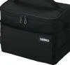
Drinks warm up fast during summer haunted-spot exploration, so a 5-layer insulated soft cooler with an ice pack gives peace of mind. At 3–5L, holding about two 500ml bottles, it's easy to carry beside a car seat or as a secondary bag on foot.
THERMOS Soft Cooler 5L, All Black RFD-0051
We may earn a referral fee on purchases made through these links.
The Night Side: Ghost Stories and Haunted Places of This Town
So far we have walked the daytime face of Shimokawa: a mountain where gold was dug, a mountain where copper was dug, stones stacked by human hands, and an inn of the pioneers. The town changed from a life of digging out to a life of raising and growing.
In this town there is no place we can confirm as a widely known haunted spot. In our view, the presence that lingers at mine sites that residents left all at once is rooted not in rumor but in the memory of the people who worked, lived and were forced to leave there.
On KARASU CHANNEL, we set out true ghost stories and haunted places not to visit them but to record them. Having learned the daytime scenery, please read the stories of the night as well.
Before You Go
Opening hours, fees, closing days and access change easily, so they are not listed in this article. Before you go, please check the latest information on the official website of each facility or local government. Some places may be restricted from entry because of weather or disasters.
Frequently Asked Questions
Q. What does the name Shimokawa mean?
A. It is said to come from an Ainu word meaning the Nukanan River downstream. The name of an ekitei from the pioneer days later became the town’s name.
Q. Who built the Mini Great Wall of China?
A. Volunteer townspeople stacked the stones over 15 years. Planning began around 1981, and the full 2,000 meters was completed in 2000.
Q. Are Shimokawa’s mines still operating?
A. No. The Shimokawa Mine suspended operations in 1983 and the Sanru Mine in 1986. Dangers may remain at the sites, so please do not enter carelessly.
Sources consulted
https://ja.wikipedia.org/wiki/下川町
https://ja.wikipedia.org/wiki/ミニ万里の長城
https://ja.wikipedia.org/wiki/下川鉱山
https://ja.wikipedia.org/wiki/珊瑠鉱山
https://ja.wikipedia.org/wiki/下川駅

Supervised by Suzuking.
Affiliation: KARASU CHANNEL
Occult & horror reporting: 7 years (since 2020)
Followers: YouTube 5,000+ / X 25,000+
On-site investigations: 30+