Nakatonbetsu Sights: Japan’s Northernmost Cave and the Gold-Dust Hills
Supervised by Suzuking. (KARASU CHANNEL / Occult & horror reporting, 7 years)
Contents
Places to visit in this town (north to south)
Numbers follow the order in the article, from north to south. Select a pin to see its name. Positions are approximate.
- Nakatonbetsu Limestone Cave (中頓別鍾乳洞) The northernmost limestone cave in the area under Japanese administration. A rare karst cave formed as shell-derived limestone dissolved away.
- Site of Nakatonbetsu Station (Tenhoku Line Memorial Park) (中頓別駅跡(天北線メモリアルパーク)) The site of a Tenhoku Line station closed in 1989. A memorial park has been laid out on the former station grounds.
- Gokokuzan Daihoji Temple (護国山 大法寺) A temple along National Route 275, welcoming pilgrims as Temple No. 23 of the Hokkaido 33 Kannon Pilgrimage.
- Mt. Pinneshiri (敏音知岳(ピンネシリ岳)) A mountain of about 700 meters bearing an Ainu name meaning "male mountain." Rishiri Fuji can be seen on clear days.
- Pinneshiri Hot Spring and Roadside Station Pinneshiri (ピンネシリ温泉と道の駅ピンネシリ) A hot spring and roadside station near the old Pinneshiri Station on the Tenhoku Line. Popular for its warmed cold mineral water, and close to the trailhead.
Show basic information about this town (location, last checked, notes)
- Location
- Nakatonbetsu, Hokkaido, Japan
- Last checked
- 2026.10.06
- Please note
- Opening hours, prices and closing days change often, so we do not list them. Please check each facility's official site before you go.
What Kind of Town Is Nakatonbetsu?
Nakatonbetsu is a mountain town in the southern part of Soya Subprefecture, Hokkaido. It is known as the only municipality in the Soya area, and the northernmost in Japan, that does not face the sea. Forest covers about 80 percent of the town’s area, and the Tonbetsu River flows through it at an unhurried pace.
This article introduces the sights of the town in order of latitude, from north to south. We start with Japan’s northernmost limestone cave, then head south through the site of a closed railway station and an old temple, to the hot spring at the foot of Mt. Pinneshiri, known as the “male mountain.” The memory of the Meiji-era gold rush is also an important part of the town’s history.
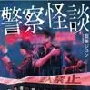
A collection of true ghost stories passed down among police officers — a reference for our reading-feature articles.
Police Ghost Stories: Scary Tales Left Out of the Report (Jun Aimine / KADOKAWA)
We may earn a referral fee on purchases made through these links.
1. Nakatonbetsu Limestone Cave (中頓別鍾乳洞)
Nakatonbetsu Limestone Cave is in Asahidai, in the east of the town, and is said to be the northernmost cave in the area under Japanese administration. It was discovered in 1933 when a packhorse driver went in to shelter from a blizzard. In 1938 it was designated a Natural Monument by the Minister of Education, and after a later change in the system it is now a Hokkaido-designated Natural Monument.
The cave lies on Japan’s northernmost karst plateau and was formed as limestone derived from shells dissolved away. This origin is said to be rare in Japan. There are four caverns, of which the first, third and fourth are open to the public. Inside, a creature known only from this cave, the Nakatonbetsu cave spring-tail (Nakatonbetsu hora toge tobimushi), has been found.
It is maintained as a nature park and is open from May to around October, closing in winter. A Limestone Cave Festival is held every year on the first Sunday of June. The cave is slippery and cold inside, so please bring comfortable shoes and a jacket, and follow the instructions when you visit.
2. Site of Nakatonbetsu Station (Tenhoku Line Memorial Park) (中頓別駅跡(天北線メモリアルパーク))
Nakatonbetsu Station opened in 1916 (Taisho 5) and later became a station on the Tenhoku Line. On May 1, 1989 (Heisei 1), it was closed along with the abolition of the entire Tenhoku Line, and a memorial park was completed on the site in 1990. The Tenhoku Line was a route on which the express “Tenhoku” ran.
The station took the character for “middle” in its name because it stands in the middle reaches of the Tonbetsu River. The town became “Nakatonbetsu Village” in 1921, so the station opened five years earlier. The station building was rebuilt in reinforced concrete in 1975, with the town buying Japanese National Railways bonds to pay for it, and it is said to have had flush toilets, which were rare for a local line at the time.
The Tenhoku Line was built as the original route of the Soya Main Line, and is said to have also played a role as a link to southern Karafuto (Sakhalin). After its closure, the old track bed was reborn as a cycling road and other uses. The memorial park is a place that quietly recalls the era when the railway supported this town.
3. Gokokuzan Daihoji Temple (護国山 大法寺)
Daihoji is a temple along National Route 275 in the center of Nakatonbetsu, and its mountain name (sango) is Gokokuzan. It is said to be Temple No. 23 of the Hokkaido 33 Kannon Pilgrimage, and is known as a place of prayer for pilgrims who travel the circuit. Through the history of settling the northern land, it has been a place that people have relied on in their hearts.
The Hokkaido 33 Kannon Pilgrimage is a pilgrim route linking temples across Hokkaido, a culture in which faith and travel are joined. This is our speculation, but a temple enshrining Kannon in a mountain settlement may be evidence that people living amid harsh nature held prayer dear.
This is a temple in active use, so when you visit, please show respect for the faith and keep quiet. Take care not to disturb worshippers or local people on the grounds. It is reassuring to check in advance whether visits are possible and at what hours.
4. Mt. Pinneshiri (敏音知岳(ピンネシリ岳))
Mt. Pinneshiri is a mountain of about 700 meters rising in the center of the town. Its name comes from the Ainu “Pin-ne-shiri (the mountain that is male).” Within the town there is also a mountain called Mt. Matsuneshiri, which is considered its female counterpart. The sight of the male and female mountains standing side by side, named by the Ainu people with affection and respect for nature, shows a delicate sensibility.
It is said that from the summit on a clear day you can see both the Sea of Japan and the Sea of Okhotsk, and, in good conditions, Rishiri Fuji as well. Being in a town with no coastline yet able to look out on two seas at once is a charm unique to this mountain. For climbing, there is a route that starts from the Pinneshiri side, where the hot spring is.
The weather on the mountain changes suddenly, and it is also brown bear habitat. When climbing, please check the latest trail conditions and warnings, carry bear bells and the like, and avoid going alone.
5. Pinneshiri Hot Spring and Roadside Station Pinneshiri (ピンネシリ温泉と道の駅ピンネシリ)
Pinneshiri Hot Spring is in Pinneshiri, Nakatonbetsu, right across from Roadside Station Pinneshiri on National Route 275. The place is near the site of Pinneshiri Station on the Tenhoku Line, which closed in 1989. It began when digging for groundwater produced a cold mineral spring, and a hot spring facility was built that heats the water for use.
The spring is a sodium-magnesium-bicarbonate-chloride type, a cold mineral spring with a source temperature as low as 4.8 degrees. Local residents took the lead in drilling in 1985, a third-sector operating company was founded in 1987, and the spring opened in 1989. The history of the townspeople striking a hot spring with their own hands is a source of pride for the mountain town.
Roadside Station Pinneshiri is said to have an auto-campground, cottages and a local products corner, and development making use of the old station site is under way. It is also a base for climbing Mt. Pinneshiri. Operating conditions change easily, so please check the latest information before you go.
Local Specialties, Food and Drink
One of Nakatonbetsu’s specialties is the town’s brand milk. Milk made by a method of slow, low-temperature pasteurization without homogenizing it, and ice cream made from that milk, are introduced. Baked sweets using domestic honey and other products made with careful attention to ingredients are also produced.
Another is a ramen sold only at the roadside station, a noodle dish themed on the “gold rush” and made with gold leaf. This is our speculation, but it may be an attempt to convey the history of Meiji-era gold panning in the form of food. Availability and content change easily, so please check the latest information before you go.
Rare Creatures and Nature
Mt. Pinneshiri and Mt. Matsuneshiri rise in the center of the town, with mountains continuing from the Teshio Mountains to the west and the foothills of the Kitami Mountains spreading to the east. There are many mountains, including Mt. Poronupuri (841 meters), Mt. Chikomadake, Mt. Penke and Mt. Panke. The Tonbetsu River running through the town waters the life of the town.
There is the Sasano River, commonly called the “crayfish river,” which speaks of the richness of the town’s nature. On Japan’s northernmost karst plateau you can also see the rare scenery of a limestone cave. Some creatures are found nowhere else, making this a great treasure house of nature in a small town.
Winters are severe, with days that fall below minus 30 degrees. The town is designated a special heavy-snow area, so please take great care over winter road conditions.
Other Notable Things About This Town
The town’s history holds the memory of Meiji-era gold panning, the so-called gold rush. A gold panning experience site on the Pechan River in Heian, within the town, is introduced, and it is known as a place where you can experience the bustle of those days.
The town’s name comes from 1916 (Taisho 5), when the Tonbetsu River basin split off from Esashi Village to become Tonbetsu Village, and in 1921, when the upper and middle reaches of the river split off, it was named “Nakatonbetsu Village” after the town area that already had Nakatonbetsu Station.
The Japanese-style and Western-style buildings of the former Tambaya Inn in the town are designated Registered Tangible Cultural Properties. The town is also known for its connection to Haruki Murakami’s short story “Drive My Car.”

A palm-sized, battery-powered digital thermo-hygrometer — record the indoor temperature and humidity while reporting at a ruin or haunted spot, adding an objective number alongside a note like "it suddenly felt colder."
dretec Digital Thermo-Hygrometer 'Corone' White O-415WT
We may earn a referral fee on purchases made through these links.
The Night Side: Ghost Stories and Haunted Places of This Town
So far we have followed the daytime face of Nakatonbetsu from north to south: Japan’s northernmost limestone cave, a station on an abandoned line, the male mountain, the memory of gold dust. Every one of these places carries layers of time lived by people who chased dreams and a living in the mountains.
As for the night side, we have not been able to identify any story that stands as a ghost tale or haunted spot. In our view, the darkness of the cave and the look of the station on the abandoned line have something of the air of a doorway into a story. The cave is open only for a limited season, and the mountains are brown bear habitat. Please never go searching for anything after dark.
On Karasu Channel, we set out true ghost stories and haunted places not to visit them but to record them. Having learned the daytime scenery, please read the stories of the night as well.
Before You Go
Opening hours, fees, closing days and access change easily, so they are not listed in this article. Before you go, please check the latest information on the official website of each facility or local government. Some places may be restricted from entry because of weather or disasters.
Frequently Asked Questions
Q. When can I visit Nakatonbetsu Limestone Cave?
A. The cave is usually open from May to around October and closes in winter. Please check the town’s information for the latest opening status.
Q. Does Nakatonbetsu face the sea?
A. No. It is known as the northernmost municipality in Japan that does not face the sea.
Q. What kind of mountain is Mt. Pinneshiri?
A. It is a mountain of about 700 meters; on a clear day you can see the Sea of Japan and the Sea of Okhotsk, and in good conditions Rishiri Fuji. Watch out for brown bears.
Official sites and references consulted
https://ja.wikipedia.org/wiki/中頓別町
https://ja.wikipedia.org/wiki/中頓別鍾乳洞
https://ja.wikipedia.org/wiki/ピンネシリ温泉
https://ja.wikipedia.org/wiki/中頓別駅
https://tabi-mag.jp/ho1053/
https://tabi-mag.jp/ho1098/
https://www.satofull.jp/town-nakatombetsu-hokkaido/special.php

Supervised by Suzuking.
Affiliation: KARASU CHANNEL
Occult & horror reporting: 7 years (since 2020)
Followers: YouTube 5,000+ / X 25,000+
On-site investigations: 30+