Rausu Sights: Shiretoko’s East Coast and Kunashiri
Supervised by Suzuking. (KARASU CHANNEL / Occult & horror reporting, 7 years)
Contents
Places to visit in this town (north to south)
Numbers follow the order in the article, from north to south. Select a pin to see its name. Positions are approximate.
- Shiretoko Rausu Visitor Center (知床羅臼ビジターセンター) The nature center for the Rausu side of Shiretoko National Park. It opened in 1983 and was renewed in 2007.
- Kumagoe Falls (熊越の滝) One of Rausu's waterfalls, inside Shiretoko National Park beside the national highway. Known as a scenic spot where a mountain stream drops.
- Michi-no-Eki Shiretoko Rausu (道の駅 知床・らうす) A roadside station in the town center, opened in 1999. The gateway to a town with a deep-ocean-water intake facility.
- Rausu Kunashiri Observation Tower (羅臼国後展望塔) An observation tower on a 167 m hill. Across the Nemuro Strait you can look out to Kunashiri Island in the Northern Territories.
- Rausu Town Local History Museum (羅臼町郷土資料館) A museum displaying finds from the Matsuhogawa Hokugan Site and more. It conveys the life of the ancient Okhotsk culture.
Show basic information about this town (location, last checked, notes)
- Location
- Rausu, Hokkaido, Japan
- Last checked
- 2026.10.06
- Please note
- Opening hours, prices and closing days change often, so we do not list them. Please check each facility's official site before you go.
What Kind of Town Is Rausu?
Rausu is a town in Menashi District on the southeastern side of the Shiretoko Peninsula in eastern Hokkaido. It shares the peninsula with the town of Shari and faces Kunashiri Island, one of the Northern Territories, across the Nemuro Strait. Because steep mountains press close behind the coast, there is little flat land, and settlements have been built on narrow strips along the rivers and the sea.
The town’s name comes from the Ainu language, and there are several interpretations: one takes “Raushi” to mean a low place, another gives it a meaning connected with the viscera. In this article we introduce the sights within the town in order of descending latitude, that is, from north to south. The route runs from a waterfall in the mountains to the coastal town center and on to a museum in the south, tracing the eastern side of Shiretoko. Please take a look at the other face of Shiretoko, which was registered as a World Natural Heritage Site in 2005.

A power source for long shoots or phone charging during haunted-spot exploration.
IRIS OHYAMA Portable Power Station IBT-A60100-W, Large Capacity 60000mAh/222Wh, 200W Rated Output, Pure Sine Wave, PSE Compliant, AC/DC/USB Output, White
We may earn a referral fee on purchases made through these links.
1. Shiretoko Rausu Visitor Center (知床羅臼ビジターセンター)
The Shiretoko Rausu Visitor Center opened in 1983 (Showa 58) and was renewed in 2007 (Heisei 19). It is a facility that introduces the nature of the Rausu side of Shiretoko National Park. Located in Yunosawa, Rausu, it lets visitors learn through exhibits about Shiretoko’s nature and the lives of the animals that live there.
On the Shiretoko Peninsula, the climate differs greatly between the Shari side and the Rausu side, divided by the ridge. The Shari side is said to have hot summers and harsh winters, while the Rausu side has cool summers and unstable weather, with frequent strong winds and rain. In February 2015, a stalled low-pressure system brought record heavy snow, and the national highway connecting the town to the outside was closed for three days.
In our view, this facility quietly teaches that nature registered as World Heritage lives side by side not only with beauty but also with a severity that threatens daily life. In 2023, the first brown bear advisory was issued within the town. This is land where wild animals live, so when visiting please be sure to check the latest caution information.
2. Kumagoe Falls (熊越の滝)
Kumagoe Falls is a waterfall in Rausu, introduced as one of the falls of Shiretoko National Park. It lies near National Route 334 and is described as a place you come upon along the road leading from the town center into the mountains. Elsewhere in the town there are other falls as well, such as Seseki Falls, Otoko-daki (Male Falls) and Onna-daki (Female Falls).
Because Rausu’s rivers are short and the distance between coast and mountains is small, scenes of steep streams plunging over falls are numerous. Many river names, such as the Uebetsu, Rausu, Chinishibetsu and Sashirui, are said to derive from the Ainu language. The bounty of the mountains is said to flow into the sea and make rich fishing grounds.
This is only our speculation, but the character for “bear” in the falls’ name may suggest that this valley was once a path of the brown bear. We have not been able to confirm reliable material on the origin of the name. The mountain area is where bears are active. When visiting, please check the latest caution information and avoid going alone.
3. Michi-no-Eki Shiretoko Rausu (道の駅 知床・らうす)
Michi-no-Eki Shiretoko Rausu is a roadside station in the Rausu town center that opened in 1999 (Heisei 11). In the same year the town built Hokkaido’s first facility to draw deep ocean water up from the land. Since 2007, full-scale intake has been carried out at a water supply facility completed at Rausu Fishing Port.
In the sea off Rausu there is a phenomenon in which cold water from the deep wells up, and this is thought to lie behind the rich fishing grounds. The town is a fishing town, and it is said that more than 60 percent of those employed work in fishery-related jobs. The catch centers on autumn salmon, squid, walleye pollock, kelp and Atka mackerel.
In our view, the town’s respect for the sea can be seen in how it has tried to use the bounty of the deep sea in fishing, in daily life and in research. In summer, a kelp event is also said to be held. Opening days and what is sold can change, so please check before you visit.
4. Rausu Kunashiri Observation Tower (羅臼国後展望塔)
The Rausu Kunashiri Observation Tower is a tower built on a hill 167 meters above sea level, overlooking the town center of Rausu. Across the Nemuro Strait, it gives a close view of Kunashiri Island on the far side of the sea. Because the town faces the island, this tower has long been counted as one of its main tourist attractions.
Kunashiri Island across the water once had deep ties with the people of this town. It is recorded that in the Edo period, in 1789, a sad event called the “Kunashiri-Menashi Battle” took place on Kunashiri and in this Rausu area, then known as Menashi. Ainu people, unable to bear harsh labor and treatment, rose up, and many lost their lives.
In our view, the scenery looking toward Kunashiri is beautiful, and it is also a place that reminds us of today’s territorial issue and the long history engraved in this sea. The tower’s opening status can change, so please check the town’s information before you visit.
5. Rausu Town Local History Museum (羅臼町郷土資料館)
The Rausu Town Local History Museum, in Minehama in the south of the town, is a facility that conveys local history. Here, finds from the Matsuhogawa Hokugan Site, designated an Important Cultural Property of Japan, are said to be on display. It is also known for exhibiting silver ornaments said to be the oldest in Japan.
The Matsuhogawa Hokugan Site is the remains of a village of the Okhotsk culture people of around the 8th century. This culture was carried on along the coast of the Sea of Okhotsk by people who crossed from the north, from the direction of Sakhalin. At this site, many charred wooden objects have been found in the remains of dwellings that burned in a fire, and among them are said to be what appear to be miniature boats.
This is only our speculation, but the discovery of boat models may suggest that boats were at the center of life for the people of this village and were also objects of worship. Exhibits and opening hours can change, so please check before you visit.
Local Specialties, Food and Drink
Rausu is a fishing town built on the sea of Shiretoko, with autumn salmon, squid, walleye pollock, kelp and Atka mackerel at the center of its landings. Each summer the town is also said to hold a kelp event.
Because this article deals only with products we could verify, we do not list specific shop or dish names. Rausu Onsen is said to have an open-air bath that can be entered free of charge, but availability can change, so please check the latest information with the town.
Rare Creatures and Nature
Rausu lies on the eastern side of the Shiretoko Peninsula, and Shiretoko was registered as a World Natural Heritage Site in 2005. Scenic places are scattered through the town, including mountains such as Mount Rausu and Mount Chinishibetsu, Lake Rausu, Kumagoe Falls and Seseki Falls.
The Rausu Geyser near Rausu Onsen was designated a Hokkaido Natural Monument in 1968. It is said to have begun to spout after a swarm of earthquakes around Mount Rausu in 1962, and it is reported that its eruptions are now smaller and its intervals longer. Within the town, the luminous moss is also known as a prefectural natural monument.
Other Notable Things About This Town
Rausu began in 1901 when it was separated from Shibetsu and the Uebetsu Village head office was set up. It was renamed Rausu Village in 1930 and became the town of Rausu when it adopted town status in 1961. It was designated part of Shiretoko National Park in 1964, and the Shiretoko Cross-Peninsula Road opened in 1980.
In ancient times, Jomon-period ornaments and jewel stones have been found, and from the Nara period onward the distinctive Tobinitai culture is said to have flourished. In 1858, in the Edo period, the explorer Matsuura Takeshiro visited Shiretoko and left many records. The town’s history layers the lives of the Ainu people with the work of many different eras.
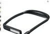
A neck-worn light for exploring a ruin or mountain haunted spot, freeing both hands from holding a flashlight so you can watch your footing or handle notes and a camera.
SANWA SUPPLY Neck Light, LED, Rechargeable, Hands-Free Neck-Worn LED Light, IPX4 Waterproof, Black, Up to 180 Lumens 800-LED075
We may earn a referral fee on purchases made through these links.
The Night Side: Ghost Stories and Haunted Places of This Town
By day, Rausu is a quiet fishing town whose settlements line up between the sea facing Kunashiri and the steep mountains. But at night, when fishing lights illuminate the sea and darkness swallows the mountains, it shows a face entirely different from the day.
On this site we also introduce ghost stories and haunted spots across Hokkaido, not to visit them but to record them. After learning the daytime scenery and history, please read the articles in the ghost-story category as well; the same land should look different again.
Before You Go
Opening hours, fees, closing days and access change easily, so they are not listed in this article. Before you go, please check the latest information on the official website of each facility or local government. Some places may be restricted from entry because of weather or disasters.
Frequently Asked Questions
Q. Can Kunashiri Island be seen from Rausu?
A. The town faces Kunashiri across the Nemuro Strait, and it can be seen on a clear day. There is an observation tower on a hill in the town from which you can look toward the island.
Q. Where does the name Rausu come from?
A. It comes from the Ainu language, and there are several interpretations, such as a theory that it means a low place and another that it has a meaning connected with the viscera. It has not been settled.
Q. Do I need to watch for brown bears in Rausu?
A. In 2023 the first brown bear advisory was issued within the town. In the mountains and along rivers, please check the latest caution information and avoid going alone.
Sources consulted
https://ja.wikipedia.org/wiki/羅臼町
https://ja.wikipedia.org/wiki/羅臼温泉
https://ja.wikipedia.org/wiki/知床国立公園
https://ja.wikipedia.org/wiki/イタオマチプ

Supervised by Suzuking.
Affiliation: KARASU CHANNEL
Occult & horror reporting: 7 years (since 2020)
Followers: YouTube 5,000+ / X 25,000+
On-site investigations: 30+