Saroma Sights: Japan’s Largest Brackish Lake
Supervised by Suzuking. (KARASU CHANNEL / Occult & horror reporting, 7 years)
Contents
Places to visit in this town (north to south)
Numbers follow the order in the article, from north to south. Select a pin to see its name. Positions are approximate.
- Kimuanepp Cape (キムアネップ岬) A cape jutting out on the southern shore of Lake Saroma. The lake, the sunset and native plants, with a campground.
- Roadside Station Saroma-ko (道の駅サロマ湖) A roadside station near the lake. Doubling as the town's tourist information center, it offers local goods and travel information.
- Lake Saroma Observatory (サロマ湖展望台) An observatory at the summit of Mt. Horoiwa, about 376 m. A must-visit with a full view of Lake Saroma.
- Piraoro Observatory (ピラオロ展望台) An observatory along the national route. It brings the magnificent Lake Saroma close and serves as a base for lakeside strolls.
- Tochigi Shrine (栃木神社) A shrine in the Tochigi district, divided from Utsunomiya Futaarasan Shrine. It tells the history of pioneers who moved from Yanaka Village.
Show basic information about this town (location, last checked, notes)
- Location
- Saroma, Tokoro, Hokkaido, Japan
- Last checked
- 2026.10.06
- Please note
- Opening hours, prices and closing days change often, so we do not list them. Please check each facility's official site before you go.
What Kind of Town Is Saroma?
Saroma is a town located almost in the center of Okhotsk Subprefecture, whose northern side faces Lake Saroma, the largest brackish lake in Japan. Scallops and oysters raised in the lake and pumpkins grown in the fields are the town’s specialties. The town’s name is said to derive from an Ainu word meaning “a place with reeds.”
In this article we introduce the town’s sights in order of descending latitude, that is, from north to south along the lakeshore. From a cape and observatories with views of the lake to a shrine that tells of pioneer history, please read about Saroma’s daytime face as one continuous journey.
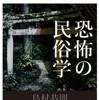
Folklorist Yasunori Shimamura unpacks what makes something "scary" — a reference for our yokai and strange-phenomena analysis pieces.
The Folklore of Fear (Yasunori Shimamura / SB Creative)
We may earn a referral fee on purchases made through these links.
1. Kimuanepp Cape (キムアネップ岬)
Kimuanepp Cape is a cape that juts out on the southern shore of Lake Saroma, toward the east. It is a place not to be missed for understanding the terrain around the lake. The town’s tourist guide introduces its charms as the lake spreading before you, the sunset lighting the lake surface, and the abundant native plants around it.
Looking at the lakebed topography, Lake Saroma has a shallow part around this cape that divides it into two basins, east and west. In other words, it is also an important place for understanding the shape of the lake. The cape has a campground, where you can spend a night on the lakeshore.
The wind on the lake is strong, and it gets cold suddenly after sunset. When going to see the sunset, please prepare for the cold and return to a safe place before dark. Please do not trample or take home the native plants.
2. Roadside Station Saroma-ko (道の駅サロマ湖)
Roadside Station Saroma-ko is located on the shore of Lake Saroma and is introduced as a base for traveling in Saroma. A specialty products hall stands on the same grounds, where you can buy the town’s products.
The town’s specialties are scallops and oysters raised in the lake, and pumpkins from the fields. A pumpkin-themed festival, the “Cinderella Dream Festival,” was once held, but it ended in 2022. Now the annual “Saroma Grand Harvest Festival” is considered the town’s representative festival.
The town’s fishing is based at the lakeside Hamasaroma Fishing Port and Tomitake Fishing Port, and scallops raised in the lake support life in the town. Here you can feel that the town has lived together with the lake. Opening days and goods change with the season, so please check the latest information before you go.
3. Lake Saroma Observatory (Mt. Horoiwa) (サロマ湖展望台)
The Lake Saroma Observatory is an observatory that opened in 1989 at the summit of Mt. Horoiwa (376 m above sea level), which rises on the lakeshore. The town’s guide also lists it as the only place with a full view of Lake Saroma and a famous spot that visitors to Saroma always stop at.
To reach the observatory there is an observatory road you can drive up, as well as the Mt. Horoiwa hiking trail, which takes about one hour one way on foot. It is introduced as a place where the magnificent view that opens up after the effort of climbing moves your heart. The observatory was renovated and refurbished because of aging. The observatory road is one-way, so please follow the signs.
Lake Saroma is a lagoon separated from the Sea of Okhotsk by a sandbar 26 kilometers long. Its area is about 152 square kilometers, the largest of any brackish lake in Japan. The shape of the lake seen from the summit lets you feel the form of that sandbar. Lake Saroma was originally a bay of the sea cut off by sand, and the lake is said to have come into being about a thousand years ago. When climbing, wear clothes you can move in, bring plenty of water, and watch out for sudden changes in the weather.
4. Piraoro Observatory (ピラオロ展望台)
Piraoro Observatory is an observatory in the Tomitake district along National Route 238. The town’s tourist guide introduces it as a place where you can feel the magnificent Lake Saroma close at hand. Unlike an observatory on a mountaintop, its appeal is that you can view the scenery from an eye level close to the lake surface.
Nearby is the Lake Saroma Lakeside Promenade, which runs along the lakeshore for about five kilometers. It is described as a path where you can walk while enjoying forest bathing, and you can stroll slowly while enjoying the lake scenery.
The lakeshore is windy and especially severely cold in winter. When stopping by car, do not park on the road shoulder; be sure to use a parking space. The footing at the water’s edge is unstable, so do not get too close to it.
5. Tochigi Shrine (栃木神社)
Tochigi Shrine is a shrine in the Tochigi district of Saroma. It is said to have been enshrined by dividing the deity of Utsunomiya Futaarasan Shrine in Tochigi Prefecture. The name Tochigi is tied to the history of people who left their distant homeland and moved to this land.
In 1911, people of Yanaka Village in Tochigi Prefecture, who had suffered from the Ashio copper mine pollution incident, left their home and moved to this land, then called the Saromabetsu wilderness. But in the harsh natural environment, most of the settlers could not take root. In 1971, thirteen farming households in the Tochigi district submitted a petition to the governor of Tochigi Prefecture and others asking to return to the prefecture.
The shrine may have been a place where such people put their hands together in longing for home. This is only conjecture, but the place name and the divided deity may have expressed the wish of people not to lose their connection to their homeland. It is still a place of prayer. When visiting, please bow before entering the grounds and put your hands together quietly. Please do not touch things in the shrine buildings or grounds, or shout loudly.
Local Specialties, Food and Drink
Saroma’s food means scallops and oysters from Lake Saroma. Aquaculture is thriving, centered on the lakeside Hamasaroma Fishing Port and Tomitake Fishing Port.
In the fields, pumpkins, a specialty, are grown. In the hills, field crops, dairy farming and forestry are also carried on. Shops and seasons change easily, so please check the latest information before you go.
Rare Creatures and Nature
Lake Saroma is the largest lake in Hokkaido and is included in Abashiri Quasi-National Park. The lake is separated from the Sea of Okhotsk by a long sandbar, said to have formed about a thousand years ago. Native flower gardens spread around the sandbar, where rare plants can be seen.
The sun setting into the lake is one of the representative views of the lakeshore. Please do not approach wild birds and plants carelessly, and show consideration for nature by taking your trash home.
Other Notable Things About This Town
Saroma’s founding is said to date to 1894, when Suzuki Jingoro from Aomori Prefecture settled in Hamasaroma. In 1911 people of Yanaka Village in Tochigi Prefecture moved to the Saromabetsu wilderness, and the present Tochigi district was born.
Every year in late June the Lake Saroma 100 km Ultra Marathon is held, gathering many runners from across the country. The Saroma Grand Harvest Festival in autumn is the town’s representative festival, an event giving thanks for the bounty of the lake and fields.
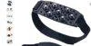
A simple slip-on spike that turns any shoe into a non-slip one for exploring a ruin or icy mountain road in winter. Less bulky than full crampons, this compact type is easy to carry, guarding against falls during a snow-season test-of-courage trip or ruin exploration.
CAPTAIN STAG Shoe Anti-Slip Grips 'Suberanzo', Compact Soft Type
We may earn a referral fee on purchases made through these links.
The Night Side: Ghost Stories and Haunted Spots of This Town
So far we have followed the daytime face of Saroma from north to south: a cape on the lakeshore, a roadside station, observatories, a pioneer shrine. At every place the time of people who lived together with the lake and opened up a new land is layered.
As for the night side, we have not confirmed any story that can be identified as a ghost story or haunted spot. In our view, the feelings of the people who left their homeland and entered the wilderness seem to remain quietly in the form of the shrine and place names. Still, this is only the movement of a visitor’s heart. The shrine is still a place of prayer, so please do not visit at night or enter out of curiosity.
On KARASU CHANNEL, we set out true ghost stories and haunted places not to visit them but to record them. Having learned the daytime scenery, please read the stories of the night as well.
Before You Go
Opening hours, fees, closing days and access change easily, so they are not listed in this article. Before you go, please check the latest information on the official website of each facility or local government. Some places may be restricted from entry because of weather or disasters.
Frequently Asked Questions
Q. How big is Lake Saroma?
A. Its area is about 152 square kilometers, and it is the largest lake in Hokkaido. It is the largest brackish lake in Japan and is said to be the third largest lake in Japan after Lake Biwa and Lake Kasumigaura.
Q. How do I get to the Lake Saroma Observatory?
A. There is an observatory road you can drive up, and the Mt. Horoiwa hiking trail, which takes about one hour one way. The observatory road is one-way, so please follow the on-site signs.
Q. How do I get to Saroma?
A. The nearest airport is Memanbetsu Airport, and you go by car or bus. The sights in town are far apart, so traveling by car is the norm. Roads freeze in winter, so please plan with time to spare.
Sources consulted
https://ja.wikipedia.org/wiki/佐呂間町
https://ja.wikipedia.org/wiki/サロマ湖
https://ja.wikipedia.org/wiki/谷中村
https://www.town.saroma.hokkaido.jp/kakuka/keizaika/2012-0326-1022-15.html
https://www.town.saroma.hokkaido.jp/kakuka/keizaika/2012-0330-1025-15.html

Supervised by Suzuking.
Affiliation: KARASU CHANNEL
Occult & horror reporting: 7 years (since 2020)
Followers: YouTube 5,000+ / X 25,000+
On-site investigations: 30+