Shosanbetsu Sights: Japan’s Northernmost Observatory and a Red Torii Gate Amid the Waves
Supervised by Suzuking. (KARASU CHANNEL / Occult & horror reporting, 7 years)
Contents
Places to visit in this town (north to south)
Numbers follow the order in the article, from north to south. Select a pin to see its name. Positions are approximate.
- Konpira Cape and Konpira Shrine (金比羅岬と金比羅神社) A cape at Toyomisaki where a red torii stands amid the waves of the Sea of Japan. Beside the lighthouse, it has watched over the safety of the sea.
- Misakidai Park and Roadside Station Roman Kaido Shosanbetsu (みさき台公園と道の駅 ☆ロマン街道しょ A vast park overlooking the Sea of Japan. It became a roadside station in 2007, and a hot spring, an observatory and a campground are gathered here.
- Shosanbetsu Observatory (しょさんべつ天文台) A public observatory opened in 1989 and regarded as the northernmost in Japan. Its 65-centimeter telescope lets visitors observe the night sky.
- Site of Shosanbetsu Station (初山別駅跡) The site of a Japanese National Railways Haboro Line station that closed in 1987. In the village center near the village office, it is within walking distance of the coast.
- Site of Teshio-Ariake Station (天塩有明駅跡) A closed Haboro Line station. It preserves the place name Ariake, given with the wish of "working even with the moon on your back."
Show basic information about this town (location, last checked, notes)
- Location
- Shosanbetsu, Hokkaido, Japan
- Last checked
- 2026.10.06
- Please note
- Opening hours, prices and closing days change often, so we do not list them. Please check each facility's official site before you go.
What Kind of Village Is Shosanbetsu?
Shosanbetsu is the only village in the Rumoi region of northwestern Hokkaido, facing the Sea of Japan. It has seven settlements, which run from south to north as Ariake, Sakae, Shosanbetsu, Chiyoda, Toyomisaki, Akesato and Kyosei. National Route 232, known as the “Sea of Japan Orora Line,” runs along the coast, and the village is one that travelers pass through while gazing out over the sea.
This article introduces the sights of the village in order of latitude, from north to south. We start with an observatory and a shrine on a cape, then move down through a park and finally to the sites of stations on a closed railway line. It is not a flashy place, but it is a village with quiet hours woven from the sea, the stars and the old rails.
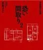
The second entry in the "Scary Floor Plans" true-ghost-story series by Tanishi Matsubara, the comedian who lives in stigmatized properties — a reference for our stigmatized-property and floor-plan analysis articles.
Stigmatized Property Ghost Stories: Scary Floor Plans 2 (Tanishi Matsubara / Futami Shobo)
We may earn a referral fee on purchases made through these links.
1. Konpira Cape and Konpira Shrine (金比羅岬と金比羅神社)
Konpira Cape is a headland in a corner of Toyomisaki, the same area as the observatory, and Konpira Cape Lighthouse stands at its tip. Konpira Shrine is enshrined on this cape, and the red torii gate standing amid the waves of the Sea of Japan is known as the scene that symbolizes the cape.
It is sometimes said that at low tide you can walk across the rocks to the foot of the torii, but the footing is wet, slippery rock, and the waves and the ebb and flow of the tide are hard to read. Do not force your way closer; viewing it from a distance is the safe way. On days of strong wind or high waves, do not go near the tip of the cape.
The name Konpira belongs to the Kompira faith, in which a god of safe voyages is enshrined in port towns across Japan. This is our speculation, but the people of this shore, who made their living from herring and other fishing, probably enshrined it to pray for safety on the often rough Sea of Japan. This is a living shrine, so please observe proper etiquette and treat it quietly as a place of prayer.
2. Misakidai Park and Roadside Station Roman Kaido Shosanbetsu (みさき台公園と道の駅 ☆ロマン街道しょさんべつ)
Misakidai Park is a village-run park spreading across a cape overlooking the Sea of Japan. In June 2007 it was registered as the roadside station “Roman Kaido Shosanbetsu,” the sixth in the Rumoi region and the 100th in Hokkaido. It covers about 20 hectares and is described as the second largest roadside station site in Hokkaido.
Inside the park are a tourist products hall, a hot-spring lodging facility, an observatory, a park golf course, an auto campground and more. From the hot spring on the heights overlooking the sea, Mount Rishiri is said to be visible floating on the horizon. The park is also known as a filming location for the popular TV drama “Hakusen Nagashi,” with the whole area serving as its setting.
As a stop along National Route 232, it is also a fine place to rest on a trip along the Orora Line. Opening hours and lodging conditions change easily, so please check the latest information from the village or the facilities before you go.
3. Shosanbetsu Observatory (しょさんべつ天文台)
Shosanbetsu Observatory stands on the cape at Toyomisaki and is regarded as the northernmost observatory in Japan. It opened in 1989 (Heisei 1), and its distinctive three-story reinforced-concrete building is said to be modeled on a lunar lander. The local youth association and the village have been involved in running it, and besides regular observation it has been open to the public for educational purposes.
Its main instrument is a 65-centimeter reflecting telescope, and several smaller telescopes complete the set. Another point of pride is that its beautiful night sky was selected in the “Star Contest” sponsored by the Environment Agency.
A unique feature is the “My Stars System,” begun in 1995, which lets you give a name of your choice to a star that is dimmer than magnitude 5.5 and does not yet have a name. By April 2020 the number of registrations was reported to have reached 10,000. Public opening days and hours differ by season, so please check the latest information before you go.
4. Site of Shosanbetsu Station (初山別駅跡)
Shosanbetsu Station opened in 1957 (Showa 32) as a station on the Japanese National Railways Haboro Line. The following year, 1958, the line was extended further and the Haboro Line was completed throughout, so the station changed from a terminus to an intermediate stop. It was closed on March 30, 1987, when the entire Haboro Line was abolished. There was also a time when the express “Haboro” stopped here.
The average number of passengers boarding and alighting per day in fiscal 1981 was 131. Around the station were the village office, the elementary and junior high schools and the post office, making it the center of the village. About 200 meters west of the station lies Shosanbetsu Beach, which is also known as a fishing spot.
The Haboro Line was an important railway running along the Sea of Japan side of Hokkaido in the Showa era, and now that it has closed, route buses have taken over its role. The area around the station site is where people live, so when you visit, please take care not to inconvenience the residents.
5. Site of Teshio-Ariake Station (天塩有明駅跡)
Teshio-Ariake Station opened in 1957, the same year as Shosanbetsu Station, as a station on the Haboro Line. In 1970 its passing facilities were abolished and it became an unstaffed station, and it was closed in 1987 along with the abolition of the entire Haboro Line. The “Teshio” in the station name was added, using the old province name, because there was already an Ariake Station on the Omito Line when it opened.
This land was originally called “Mochikubetsu,” from the Ainu word “Mochukpet” (the small Chikubetsu River). When the district names were revised in 1941, the public was invited to propose names and it was renamed “Ariake.” It is said that the name carries the meaning “working even with the moon on your back.”
The hardship of pioneer life, working from before dawn until the moon rises, seems to be carved straight into the place name, and it is moving. Around the station site a small settlement continues quietly. Every year on September 14, the Ariake lion dance, passed down by the local people, is offered at the shrine.
Local Specialties, Food and Drink
The village’s signature dish is the “Shosanbetsu natural tiger puffer teriyaki rice bowl,” made with the local specialty, the tiger puffer. This local gourmet dish began to be served in March 2009, and a soba dipping broth made with the bones of wild puffer has also been devised.
Among farm products, haskap berries and cherry tomatoes are specialties, and the haskap is also processed into jam, syrup and wine. Among seafood, octopus and puffer fish are landed, and the fishery cooperative’s processing plant makes products such as nuka-herring, nuka-Atka mackerel and vinegared squid. Availability and timing change easily, so please check the latest information before you go.
Rare Creatures and Nature
The village faces the Sea of Japan, and from the hot spring on the heights, Mount Rishiri is said to be visible floating on the horizon. The starry sky is also a source of the village’s pride, and the northernmost observatory in Japan was presumably placed here because of the beauty of the sky.
The Furenbetsu, Shosanbetsu and Mochikubetsu rivers flow through the village and into the sea. There is also Ariake Dam in the village, with mountain scenery spreading around it. It is a village where both sea and mountains are close at hand.
The area is designated a special heavy-snowfall region, with deep snow in winter and a continental climate with large temperature swings. Winter roads can become hard to travel in blizzards, so please check the latest information.
Other Notable Things About This Village
The village’s history goes back to the Matsumae-shi, written in 1781, which records place names such as Morokubetsu and Shushabetsu (Shosanbetsu). In 1900 (Meiji 33) the Shosanbetsu Village headman’s office was established, and this is regarded as the founding of the village. The second-class town and village system was applied in 1909.
There are several theories about the Ainu origin of the village name. The village’s official view is “a river where a waterfall flows out,” and the explorer Matsuura Takeshiro’s note that it means “where a waterfall falls” is considered one clue. Other theories take it to be a river of smelt or a river near a willow field.
Among the village’s natives, the hunter Yamamoto Hyokichi, who later shot the brown bear in the Sankebetsu brown bear incident, is said to have come from here. The village also has deep ties to film and television, having served as a filming location for the movie “Higuma Arashi.”
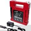
A car and disaster-prep item for unexpected trouble like a dead battery on the drive to a haunted spot.
meltec Jump Starter, Max Output DC12V/400A DC24V/600A, Lithium-Ion Battery 24000mAh MP-2, with USB Port & LED Light, 5 Protection Functions
We may earn a referral fee on purchases made through these links.
The Night Side: Ghost Stories and Haunted Spots of This Village
So far we have followed the daytime face of Shosanbetsu from north to south: an observatory gazing at the stars, a red torii amid the waves, and the stations of a closed railway. Every one of these places carries the hopes of people who lived beside the Sea of Japan.
As for a night side, we have not been able to confirm any ghost story or haunted spot that can be pinpointed here. The nights of this village belong to starlight and the sound of waves. In our view, the place name Ariake, “working even with the moon on your back,” may be the best phrase for the nights of this land. The tip of the cape and the shoreline are dangerous at night, so please do not go near them.
At KARASU CHANNEL, we publish true ghost stories and haunted spots not so that you can go there, but so that they are recorded. Once you know the daytime scenery, please read the night stories as well.
Before You Go
Opening hours, fees, closing days and access change easily, so they are not listed in this article. Before you go, please check the latest information on the official websites of each facility and local government. Some places have restricted entry because of weather or disasters.
Frequently Asked Questions
Q. What is the most famous place in Shosanbetsu?
A. The best known are Shosanbetsu Observatory, regarded as the northernmost in Japan, Konpira Cape with its red torii standing in the sea, and the vast Misakidai Park and roadside station.
Q. Can I walk to the foot of the Konpira Shrine torii?
A. It is sometimes said that you can walk there at low tide, but the rocks are slippery and changes in the waves and tide are dangerous. We recommend viewing it from a distance.
Q. What is Shosanbetsu’s specialty?
A. The “natural tiger puffer teriyaki rice bowl,” haskap products and cherry tomatoes are well known. What is served changes easily, so please check beforehand.
Sources consulted
https://ja.wikipedia.org/wiki/初山別村
https://ja.wikipedia.org/wiki/しょさんべつ天文台
https://ja.wikipedia.org/wiki/初山別駅
https://ja.wikipedia.org/wiki/天塩有明駅
https://www.mapple.net/pref/01485/spot/
https://www.hkd.mlit.go.jp/rm/tiiki_sinkou/c2dl9l0000000po1-att/c2dl9l000000113b.pdf
https://www.hokkaido-np.co.jp/movies/detail/5293147405001/

Supervised by Suzuking.
Affiliation: KARASU CHANNEL
Occult & horror reporting: 7 years (since 2020)
Followers: YouTube 5,000+ / X 25,000+
On-site investigations: 30+