Bifuka Sights: Japan’s Northernmost Raised Bog and the Terminus of the Unfinished Miyuki Line
Supervised by Suzuking. (KARASU CHANNEL / Occult & horror reporting, 7 years)
Contents
Places to visit in this town (north to south)
Numbers follow the order in the article, from north to south. Select a pin to see its name. Positions are approximate.
- Site of Onnenai Station (恩根内駅の跡) The site of a Soya Main Line station that opened in 1911. Residents' efforts once saved it, but it was closed in 2024.
- Forest Park Bifuka Island (森林公園びふかアイランド) The town's forest park on the banks of the Teshio River, listed as one of the town's tourist sights.
- Site of Niupu Station (仁宇布駅の跡) The site of the terminal station of the Miyuki Line. The track to Esashi was frozen just before completion and was never finished.
- Matsuyama Wetland (松山湿原) A raised bog at an elevation of 797 meters, regarded as the northernmost in Japan. It was designated a Nature Conservation Area in 1975.
- Bifuka Station (美深駅) A Soya Main Line station opened in 1911, in the center of town. The Miyuki Line once branched off here.
Show basic information about this town (location, last checked, notes)
- Location
- Bifuka, Hokkaido, Japan
- Last checked
- 2026.10.06
- Please note
- Opening hours, prices and closing days change often, so we do not list them. Please check each facility's official site before you go.
What Kind of Town Is Bifuka?
Bifuka is a town in the northern part of the Kamikawa region of Hokkaido. The Teshio River runs through it from north to south, with National Route 40 and the Soya Main Line running alongside. The Teshio Mountains rise to the west and the Kitami Mountains to the east, and forest covers most of the town’s area, which is also designated a special heavy-snowfall region.
The name “Bifuka” is said to come from the Ainu word “piuka,” which referred to a stony gravel bank along the Teshio River. It means “a place with many stones,” and the name of the gravel bank that once lay around today’s Bifuka Station became the name of the town. The first station name was read “Piuka,” and in 1951, after the village had been renamed Bifuka Village, the reading was changed to the present “Bifuka.”
The town has also been certified as one of Japan’s “100 Selected Waters” (Mizu no Sato Hyakusen). In a life surrounded by river and forest, there was also a history of people who dreamed of a railway. This article follows the town’s sights in order of latitude, that is, from north to south. From the northern edge of town toward the mountains in the south, we walk as if going back through time.
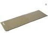
A self-inflating sleeping mat for conserving energy during a late-night stakeout or wait in the car. Laid across a seat or the cargo area, it softens the hard, cold surface and eases fatigue during a long haunted-spot stakeout.
CAPTAIN STAG Inflating Sleeping Mat UB-3005
We may earn a referral fee on purchases made through these links.
1. Site of Onnenai Station (恩根内駅の跡)
Onnenai Station was once a station on the Soya Main Line, located in the northern part of Bifuka. It opened on November 3, 1911, as the terminus of the railway extending from Nayoro Station, and the following year the line was extended toward Otoineppu. It once had staff, but became unstaffed in 1986.
Because of low ridership, the station was once slated for closure in March 2021. However, local residents started a movement, and it is said to have remained for some time with Bifuka Town covering the cost of maintaining it. Even so, it was finally closed with the timetable revision of March 2024.
After it became unstaffed, there was also a period when an unused freight car was reused as the station building. The present waiting room was built in 1993. The station site and its surroundings are farmland, the living space of local people. Please do not approach areas where entry is restricted, and be considerate of the neighborhood.
2. Forest Park Bifuka Island (森林公園びふかアイランド)
Bifuka Island is a forest park on the banks of the Teshio River in Bifuka. It is introduced as one of the town’s sights, alongside facilities such as the roadside station and the hot spring. It is a place for the townspeople to enjoy the river and the forest.
The Teshio River, which flows through the town from north to south, is also a river that Matsuura Takeshiro explored in 1857. Takeshiro went up this river, walked through the Kamikawa and Nakagawa districts, and left a record of it in his Teshio Nisshi (Teshio Diary). A park along the river can be called a place that quietly conveys the memory of the river that pioneer-era people relied on.
Please note that the position of this entry is an approximate point estimated from the place name. We have not been able to confirm the park’s facilities or the seasons in which it can be used. Before visiting, please check the town’s official information. Near the river, also watch out for changes in water level and for sightings of brown bears.
3. Site of Niupu Station (仁宇布駅の跡)
Niupu Station was the terminal station on the Miyuki Line of Japan National Railways. The Miyuki Line connected Bifuka Station on the Soya Main Line to Niupu Station over 21.2 kilometers, and the line’s name combines “Mi” from the starting point, Bifuka, with “yuki” (read from the character for “sachi”) from the planned terminus, Kitami-Esashi. Niupu Station opened on October 5, 1964.
The railway was planned to continue from Niupu over the mountains to Kitami-Esashi on the Sea of Okhotsk. The idea began in 1931, when Bifuka’s mayor and others surveyed the route on foot from Niupu over the mountains to Esashi. The roadbed, tunnels and bridges were completed, but with the enforcement of the National Railway Reconstruction Act in 1980, construction was frozen and the line was left unfinished.
The Miyuki Line was known as one of the worst-performing lines among all Japan National Railways routes, and it was closed on September 17, 1985. The position of this entry is an approximate point for the district. In our view, a railway that never reached the sea tells of the size of the dreams held by the people at the northern edge. Some of the former site is private land or dangerous ground, so please be considerate when thinking of going in.
4. Matsuyama Wetland (松山湿原)
Matsuyama Wetland is a wetland in the mountains of Bifuka. At an elevation of 797 meters and an area of about 25 hectares, it is regarded as the northernmost raised bog in Japan. In 1975 it was designated a Hokkaido Nature Conservation Area. Together with the Piyashiri Wetland to the south, it is also said to have been selected as one of Japan’s important wetlands.
In the wetland, alpine plants form colonies, and low-growing Sakhalin spruce and Siberian dwarf pine can also be seen. A total of 199 plant species have been confirmed, and dragonflies are abundant too. Within the wetland are three ponds: Ezomatsu-numa, Haimatsu-numa and Tsutsuji-numa. Near the entrance, waterfalls and Tenryu-numa pond are also said to be scattered around the mountain trail.
The mountain is open to entry from around mid-June to around mid-October. The area around Matsuyama Wetland has not been heavily developed for tourists and is sometimes called a hidden region. A wetland is fragile nature. Please do not leave the boardwalk or the designated paths, and do not forget to prepare for brown bears and for sudden changes in the weather.
5. Bifuka Station (美深駅)
Bifuka Station is a JR Soya Main Line station in the center of Bifuka. All trains, including limited expresses, stop here. It opened on November 3, 1911, when the railway from Nayoro Station to Onnenai Station was opened. It was first read “Piuka,” and in 1951 the reading was changed to the present “Bifuka.”
On October 5, 1964, the Japan National Railways Miyuki Line opened, branching off from this station. There was also the Bifuka Forest Railway, which carried timber cut in the forests and ran from 1942 to 1956. This is our speculation, but the area around the station was probably lively with the shipping of lumber.
A bell is said to be placed at the station. It may be a remnant of the dream the townspeople shared along with the Miyuki Line. The station is also part of the townspeople’s daily lives. When taking photos or looking around, please be considerate of those around you, and check the timetable in advance.
Local Specialties, Food and Drink
Bifuka’s industries are agriculture and forestry. Forest covers most of the town’s area. The town also has a hot spring and a roadside station, and local products are said to be sold there.
The best-known specialty of the town is the sturgeon. In addition to farming, dairy and forestry, sturgeon are raised in this northern town, and there is a small aquarium in town that introduces them. This is our speculation, but a land blessed with cold, clear water may have suited the farming of this fish.
There is also a small aquarium introducing sturgeon. What is sold and served changes with the season, so please check in advance.
Rare Creatures and Nature
The town lies between the Teshio Mountains to the west and the Kitami Mountains to the east. The Teshio River flows through the town from north to south, and in winter it becomes a deeply snowy land, designated a special heavy-snowfall region.
Besides Matsuyama Wetland, there are also waterfalls nearby. In the mountains and wetlands, do not forget to prepare for brown bears and to watch for changes in the weather.
Bifuka has a humid subarctic climate. The average annual temperature is 5.8 degrees Celsius, with about 85 days a year when the temperature stays below freezing all day and more than 170 days with a sub-zero low. Snowfall is also heavy, averaging about 888 centimeters a year. In January and February of 2014, days below minus 30 degrees were also recorded. Precisely because it is a land of such harsh winters, the force of the Teshio River’s water when the snow melts in spring, and the flowers of the wetland’s short summer, leave an even stronger impression.
Many of the town’s mountains carry names derived from Ainu. For example, Mt. Niupu (elevation 954 meters) is said to take its name from “niupu,” meaning “forest, or a river with trees,” and it is also the origin of the place name Niupu. Tracing the origins of mountain names conveys how the people of this land saw the forest and the river. The town’s highest peak is Mt. Hakodake, at 1,124 meters. Many mountains, such as Mt. Niupu and Mt. Numadake, have no hiking trails, and untouched nature remains.
Other Notable Things About This Town
Looking at the chronology, Bifuka is a land where people have lived since the Jomon period. In 1857, at the end of the shogunate era, the explorer Matsuura Takeshiro went up the Teshio River and walked through the Kamikawa and Nakagawa areas. In 1911 the railway was extended to Onnenai Station, and in 1915 Shimo-Nayoro Village was founded. The village name was changed to Bifuka Village in 1920, and it became a town in 1923. In the Showa era, the Miyuki Line opened in 1964, a ski area opened in 1965, and in the 2010s a road linking Nayoro and Bifuka opened, so the town’s appearance changed little by little.
In 1920, Chiebun Village was separated off, and Shimo-Nayoro Village was renamed Bifuka Village. Town status was established in 1923. In that year’s census, Bifuka Village was recorded as having 2,045 households and 10,991 people.
The Miyuki Line, which opened in 1964, was closed in 1985. The abandoned tracks were later said to have been used as a place to experience riding handcars. The town also preserves the site where the Teshio River’s name originated and several archaeological sites as cultural properties.
The town preserves as cultural properties the “Site of the Origin of the Name Teshio River” (Teshiogawa-na Yurai no Chi) as well as the Tomioka, Monponai and Kusunoki sites. They are remains that show how human life since the Jomon period continued along the Teshio River basin. Also, the “Bell of Miyuki” (Miyuki no Kane) is placed at Bifuka Station, quietly conveying the dream of the Miyuki Line that was never realized. In town there is also Kobo-ji temple, the 28th temple of the Hokkaido 33 Kannon Pilgrimage. It is an active temple, so when you visit, please respect its quiet as a place of faith.
The actor Minoru Chiaki, known for his films and stage work, is said to have come from what was once Onnenai Village. Thinking that someone who went on to success on the stage in faraway Tokyo came from Onnenai, where the station site has melted into quiet farmland, the scenery of that small northern settlement looks a little different.

Ultra-lightweight safety glasses with anti-fog and anti-scratch coating — protect your eyes from falling ceiling debris, flying glass, and dust inside a ruin.
TRUSCO Ultra-Lightweight Safety Glasses, Clear Lens SS936
We may earn a referral fee on purchases made through these links.
The Night Side: Ghost Stories and Haunted Spots of This Town
So far we have walked through the daytime face of Bifuka: a station kept alive by its residents, a railway that never reached the sea, and Japan’s northernmost wetland. Each of them let us feel the far-seeing gaze of the people at the northern edge.
We could not confirm any place in this town that is widely known as a haunted spot. In our view, the presence that lingers around abandoned lines and stations emptied of people does not come from rumor, but is rooted in dreams that were never realized and in the memories of the people who lived there.
At KARASU CHANNEL, we publish true ghost stories and haunted spots not so that people will go there, but so that they will be recorded. Having learned the daytime scenery, please read the night-time stories too.
Before You Go
Opening hours, prices, closing days and access change easily, so they are not included in this article. Before you go, please check the latest information on the official website of each facility or local government. Entry may be restricted in some places because of weather or disasters.
Frequently Asked Questions
Q. How is the name of Bifuka read?
A. It is read “Bifuka-cho.” It lies in the northern part of the Kamikawa region, and the Teshio River flows through the town from north to south.
Q. Why was the Miyuki Line closed?
A. Because it had very few passengers and extremely poor business results. Construction of the extension to Esashi was frozen in 1980, and the line was closed on September 17, 1985.
Q. When can I visit Matsuyama Wetland?
A. The mountain is said to be open from around mid-June to around mid-October. It varies from year to year, so please check the latest information.
Q. What is the origin of the name Bifuka?
A. It is said to come from “piuka,” an Ainu word meaning “a place with many stones.” It was the name of a gravel bank on the Teshio River that once lay near today’s Bifuka Station.
Sources consulted
https://ja.wikipedia.org/wiki/美深町
https://ja.wikipedia.org/wiki/美深駅
https://ja.wikipedia.org/wiki/恩根内駅
https://ja.wikipedia.org/wiki/仁宇布駅
https://ja.wikipedia.org/wiki/美幸線
https://ja.wikipedia.org/wiki/松山湿原
https://www.town.bifuka.hokkaido.jp/

Supervised by Suzuking.
Affiliation: KARASU CHANNEL
Occult & horror reporting: 7 years (since 2020)
Followers: YouTube 5,000+ / X 25,000+
On-site investigations: 30+