Tsubata Sights: Genpei Pass and Reclaimed Lagoon on the Kaga-Noto Border
Supervised by Suzuking. (KARASU CHANNEL / Occult & horror reporting, 7 years)
Contents
Places to visit in this town (north to south)
Numbers follow the order in the article, from north to south. Select a pin to see its name. Positions are approximate.
- Ishikawa Forest Park (石川県森林公園) A prefectural forest park at the foot of Mt. Mikuni. It hosted the National Tree-Planting Festival and is the town's leading green space.
- Tsubata Castle Ruins and Tsubata Furusato History Museum (津幡城跡と津幡ふるさと歴史館) The site of a castle that began as a fort in the Genpei War and was rebuilt by Maeda Toshiie. A history museum now stands here and shows the town's past.
- Himawari Mura (ひまわり村) A sunflower field on the reclaimed land of Lake Kahokugata. In summer about 350,000 flowers bloom at once, brightly conveying the history of the reclaimed ground.
- Kurikara Fudoji Temple (倶利迦羅不動寺) An old temple of the Koyasan Shingon sect on Mt. Kurikara. Its principal image is Fudo Myoo with a black dragon coiled around a sword, and it was also a prayer temple of the Kaga Maeda family.
- Kurikara Pass (倶利伽羅峠) A pass on Mt. Tonami on the Ishikawa-Toyama border. The stage of the 1183 Genpei battle, and a Historic Road that preserves the old Hokuriku Road.
- Katabata and the Reclamation of Lake Kahokugata (潟端と河北潟の干拓) A settlement of rice fields opened by the Kaga domain in the early Edo period. It is where the history of reclaiming Lake Kahokugata began.
Show basic information about this town (location, last checked, notes)
- Location
- Tsubata, Ishikawa, Japan
- Last checked
- 2026.10.05
- Please note
- Opening hours, prices and closing days change often, so we do not list them. Please check each facility's official site before you go.
What Kind of Town Is Tsubata?
Tsubata is a town almost in the middle of Ishikawa Prefecture, directly north of Kanazawa. Its name is said to come from its position at the edge of a “tsu” (port), where boats traveling between the Tsubata River and Lake Kahokugata would stop. Since ancient times it was a key point where the Hokuriku Road branched off toward Noto Province, and it prospered as a post town. The town’s territory straddles the former provinces of Kaga and Noto, so it truly sits on the border between two lands.
It has the largest population of any town in Ishikawa Prefecture and is also a commuter area for Kanazawa. At the same time, its eastern edge holds Kurikara Pass, which forms the border with Toyama Prefecture and is famous as a stage of the Genpei War. This article introduces the sights of the town in order of latitude, from north to south. The route runs from the reclaimed land of Lake Kahokugata through a castle ruin and a forest park to the pass and ancient temple in the east, crossing the town from west to east.
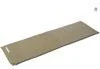
A self-inflating sleeping mat for conserving energy during a late-night stakeout or wait in the car. Laid across a seat or the cargo area, it softens the hard, cold surface and eases fatigue during a long haunted-spot stakeout.
CAPTAIN STAG Inflating Sleeping Mat UB-3005
We may earn a referral fee on purchases made through these links.
1. Ishikawa Forest Park (石川県森林公園)
Ishikawa Forest Park is a prefectural park in Tsubata. Its establishment was decided in 1971 as one of the projects commemorating the 100th anniversary of the prefecture, and it opened in May 1973. It consists of two areas: the Tsubata area, with a zoo and a boating pond, and the Mikuniyama area, with camping facilities on Mt. Mikuni. Sports facilities and open lawns are also provided.
In May 1983 it served as the venue of the 34th National Tree-Planting Festival. Being chosen to host a green event that gathered people from all over the country made the town’s forest widely known. In 1994 the National Tree-Nurturing Festival was also held in the town.
In 2023, heavy rain caused landslides and road collapses at 125 places in the park, and it was closed for a long time. Some facilities reopened from the following spring, but the extent of reopening changes, so please check the official guidance for the current situation before visiting. It is a place that makes you think about both the town’s life alongside the forest and the sheer scale of natural disasters.
2. Tsubata Castle Ruins and Tsubata Furusato History Museum (津幡城跡と津幡ふるさと歴史館)
Tsubata Castle was a flatland castle on a small hill facing the Tsubata River, and it had long been a place that controlled a vital transport point. It is said to have begun when Taira no Koremori set up a fort during the Battle of Kurikara Pass in 1183. In 1190 Tsubata Takaie, the local steward (jito), made it his residence. In 1351, during the Northern and Southern Courts period, Togashi Ujiharu fought the army of Momonoi Naotsune here.
In the Sengoku period, Ikko-ikki forces holed up here from 1576, but the castle fell in 1581 to Shibata Katsuie and others on the Oda side. In 1584, as tension rose between Sassa Narimasa and the Maeda clan, Maeda Toshiie rebuilt the castle and had his younger brother Maeda Hidetsugu defend it. It is said that in September of that year a war council was held here to decide how to deal with the Sassa army besieging Suemori Castle. In 1585, when Hidetsugu moved to Kibune Castle, the castle was abandoned.
An elementary school was later built on the castle site, and after the school buildings were relocated, the Tsubata Furusato History Museum “Rekishiru” opened in 2016. Today only a stone marker conveys the castle’s appearance, but from the lay of the land you can imagine the value of a place that successive rulers were determined to hold as a key point on the border between Kaga and Noto.
3. Himawari Mura (ひまわり村)
Himawari Mura (Sunflower Village) is a sunflower field on the Lake Kahokugata reclaimed land in Koto, Tsubata. It opened in 1995, and seeds are sown every year in late May. From late July to early August, about 350,000 sunflowers of a variety called hybrid sunflower are said to bloom across a field of about 2.3 hectares. An observation tower and a maze have also been set up so that visitors can enjoy the wide field.
This place was originally the surface of the lagoon. In the national reclamation project after World War II, most of the water surface of Lake Kahokugata was turned into farmland. Oil pressed from sunflower seeds is known as a specialty product of Tsubata.
This is our own speculation, but the effort of continuing to plant sunflowers on reclaimed land seems to carry the feelings of people trying to root a new landscape in ground that lost its water. The yellow field under a summer blue sky conveys, in a bright form, the memory of a place that used to be a lake.
4. Kurikara Fudoji Temple (倶利迦羅不動寺)
Kurikara Fudoji is a special head temple of the Koyasan Shingon sect in Kurikara, Tsubata. Its principal image is Kurikara Fudo Myoo. “Kurikara” is said to derive from a word meaning black dragon, and the name, which also became the name of the mountain, comes from the image of a black dragon coiled around a sword. Together with Narita Fudo and Oyama Fudo, it is sometimes introduced as one of the Three Great Fudo of Japan.
According to the temple’s tradition, it began in 718, when Fudo Myoo was enshrined by imperial order of Empress Gensho, and in 812 Kukai is said to have carved a statue of Fudo, opening Choraku-ji. During the battle of 1183, many of the halls, treasures and records were burned, but it is said to have been restored later by Minamoto no Yoritomo. In the Kan’ei era of the Edo period, the priest Shuga restored it, and it became a prayer temple of the Kaga Maeda family and a resting place during their alternate-attendance journeys.
In the early Meiji period, the separation of Shinto and Buddhism abolished the temple and it became Tamuke Shrine, but in 1949 halls were rebuilt on the site and it was revived as the present temple. As this is an active temple, please visit quietly and with consideration for worshippers. Behind the temple on the mountain, layers of time overlap with those of the old battlefield on the pass.
5. Kurikara Pass (倶利伽羅峠)
Kurikara Pass is a pass on Mt. Tonami, on the border between Tsubata in Ishikawa Prefecture and Oyabe in Toyama Prefecture. Beyond the pass, the Tonami Plain spreads to the east and the Kanazawa Plain to the west. The Hokuriku Road has passed through here since ancient times, and it was a vital route connecting Kaga and Etchu. In 1995 it was selected as a Historic Road by the Ministry of Construction, and in 2009 the pass road of the Hokuriku Road was designated a historic site of Ishikawa Prefecture.
What made the pass famous was the Battle of Kurikara Pass in 1183 (Juei 2). The army of Kiso Yoshinaka defeated a large Taira force commanded by Taira no Koremori and headed for Kyoto on that momentum. While the Taira are said to have had the advantage in numbers, the story told is that, attacked at night, their army fell into confusion and was destroyed as men fell one after another from the cliffs. The Genpei Josuiki also contains the “fire-oxen stratagem,” in which torches were tied to the horns of oxen that were driven at the Taira army, but it does not appear in the variant texts of The Tale of the Heike and is thought to be a fabrication based on an old Chinese tale.
Every spring a double-flowered cherry festival is also held at the pass. As it is also an old battlefield where many lives were lost, it is a place to walk with respect while learning its history. After the Meiji period began, a road was built on the northern Amata Pass side for the Emperor’s tour of Hokuriku, which later led to the national highway. The history of the pass road itself tells of the changing transport links between Hokuriku and the capital.
6. Katabata and the Reclamation of Lake Kahokugata (潟端と河北潟の干拓)
Katabata is a settlement southwest of Tsubata, on the shore of Lake Kahokugata. As the name suggests, it lies at the edge of the lagoon, and traces remain of how attempts to turn the lagoon into farmland were repeated many times since long ago. Full-scale reclamation is said to have begun around 1672 or 1673 in the early Edo period. It is said that Maeda Tsunanori, the fifth lord of the Kaga domain, resettled 21 households from Kanazawa and created about 3 hectares of new rice fields, which became the origin of Katabata Shinmura.
Lake Kahokugata was originally a lagoon said to have been sea about 5,000 years ago. Sand dunes formed and made it a lake, and from the Meiji era to the early Showa era it was an important fishery that yielded not only crucian carp but also brackish-water catches such as sea bass, mullet, whitebait and Japanese basket clams. The national reclamation project from the 1960s greatly shrank the water surface and turned it into a freshwater lake. Its area, about 23 square kilometers before reclamation, is now a little over 4 square kilometers.
A large chinquapin tree that Tsunanori is said to have planted as a memorial at that time is said to still stand on the grounds of a private house in the settlement. Because it stands on private property, please refrain from visiting just to see it and respect the life of the settlement. The long labor of people who lived with the lagoon runs beneath the history of this land.
Local Specialties, Food and Drink
The first taste to mention in Tsubata is Kurikara soba. It is buckwheat noodles made with the leaves of burdock gathered on Mt. Kurikara, and is introduced as having a pale green color and a firm texture. It is a simple dish that makes use of plain ingredients, typical of a mountain village with an old pass.
On the Lake Kahokugata reclaimed land, sunflower oil pressed from sunflower seeds is known as a specialty of the town. It is a good example of how the scenery of the fields leads directly to a food product.
In the past, Lake Kahokugata was a rich fishery yielding crucian carp, sea bass, mullet, whitebait, Japanese basket clams and more. The reclamation changed the shape of the fishery, but the memory of the food culture that lived alongside the lagoon is a clue to understanding the land’s history.
Rare Creatures and Nature
The town’s nature is represented by its forests and its lagoon. The town is certified as a forest therapy base, and in the folds of Mt. Mikuni there are facilities such as the campground of Ishikawa Forest Park.
Lake Kahokugata, meanwhile, is a lagoon formed when land that was once sea was dammed by sand dunes, and it became a freshwater lake after the reclamation. Around the reclaimed land, waterside observation places such as the Asaza biotope are also introduced as attractions of the town. It is a nature whose landscape has been remade by human hands, yet the memory of a life lived with water still breathes in the land.
At Yukan-ji Temple in the town, there is said to be a famous camellia tree called “Yukanji Meigetsu.” Enjoying the seasons in the garden of a quiet temple is another way to spend time here.
Other Notable Things About This Town
Tsubata took its present form in 1954, when the town of Tsubata merged with four surrounding villages, and it has shaped its territory since by incorporating places such as Kurikara Village. The history that its territory straddles the former provinces of Kaga and Noto, and that settlements such as Ushikubi and Uryu lay within Noto, tells much about the character of the town.
Every year on the third Sunday of September, the Tsubata Yonmachi Shishimai Kashira-awase takes place, in which the lion dances of the Shimizu, Kagatsume, Sho and Tsubata districts are performed at the Yotsukado intersection. In early October there is also an event where the lion dances of the four neighborhoods of Chujo gather, and a festival culture rooted in the community continues.
In 1964, the Tsubata River overflowed and caused a flood that killed three people and inundated 771 houses. It is a harsh side of a land that has lived with water, and a memory that must not be forgotten.
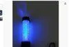
A guide-light baton for signaling between group members inside a ruin, or for fixing to a car hood with its magnet to light the surroundings — its specialty is signaling with a flashing light.
Mizukei Multi Guide Light Baton 'Yutosei' 23cm 2013001
We may earn a referral fee on purchases made through these links.
The Night Side: Ghost Stories and Haunted Places of This Town
So far we have walked through the daytime face of Tsubata: the reclaimed sunflower fields, the pioneering of Katabata, the castle ruins, the forest, the old battlefield pass, and the Fudo temple on the pass. Every one of these places carries layers of the lives of people who guarded a border, fought, and opened up the land.
That depth connects to the night side as well. On this site we cover the story of the “fire-oxen stratagem” of Kurikara Pass, and we also treat rumors about tunnels in the town as records. In our view, a ghost story is like a shadow that a land’s history and terrain have cast on people’s minds. The memory of an old battlefield where many lives were lost, and of a land on a border, may be what gives such rumors their depth.
On Karasu Channel, we set out true ghost stories and haunted places not to visit them but to record them. Having learned the daytime scenery, please read the stories of the night as well.
Before You Go
Opening hours, fees, closing days and access change easily, so they are not listed in this article. Before you go, please check the latest information on the official website of each facility or local government. Some places may be restricted from entry because of weather or disasters.
Frequently Asked Questions
Q. In what order should I tour Tsubata efficiently?
A. This article introduces the sights from north to south. It is easier to go around by grouping them by area: the reclaimed land of Lake Kahokugata, the castle ruins and forest park in the town center, and Kurikara Pass and Fudoji Temple in the east. Conditions on the pass and mountain roads change with the season and weather, so please check the official tourist information.
Q. What are the specialties of Tsubata?
A. Kurikara soba and sunflower oil are well known. Availability changes, so please check the latest information before you go.
Q. In which prefecture is Kurikara Pass?
A. It lies on the border between Tsubata in Ishikawa Prefecture and Oyabe in Toyama Prefecture. This article covers only the Tsubata side.
Official sites and references consulted
https://ja.wikipedia.org/wiki/%E6%B4%A5%E5%B9%A1%E7%94%BA
https://ja.wikipedia.org/wiki/%E6%B4%A5%E5%B9%A1%E5%9F%8E
https://ja.wikipedia.org/wiki/%E5%80%B6%E5%88%A9%E4%BC%BD%E7%BE%85%E5%B3%A0
https://ja.wikipedia.org/wiki/%E5%80%B6%E5%88%A9%E4%BC%BD%E7%BE%85%E5%B3%A0%E3%81%AE%E6%88%A6%E3%81%84
https://ja.wikipedia.org/wiki/%E5%80%B6%E5%88%A9%E8%BF%A6%E7%BE%85%E4%B8%8D%E5%8B%95%E5%AF%BA
https://ja.wikipedia.org/wiki/%E6%B2%B3%E5%8C%97%E6%BD%9F
https://ja.wikipedia.org/wiki/%E7%9F%B3%E5%B7%9D%E7%9C%8C%E6%A3%AE%E6%9E%97%E5%85%AC%E5%9C%92
https://ja.wikipedia.org/wiki/%E3%81%B2%E3%81%BE%E3%82%8F%E3%82%8A%E6%9D%91
https://ja.wikipedia.org/wiki/%E8%95%8E%E9%BA%A6

Supervised by Suzuking.
Affiliation: KARASU CHANNEL
Occult & horror reporting: 7 years (since 2020)
Followers: YouTube 5,000+ / X 25,000+
On-site investigations: 30+
Haunted locations near this town
Besides its daytime face, this land has a night side too. Read it as a record if you are curious. Some of these places are not safe or permitted to enter.
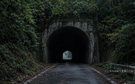
Ushikubi Tunnel (Miyajima Tunnel)
Ushikubi Tunnel is known for stalled engines and an old woman's ghost. No public records back the tales. We cover its active-road status and cautions.
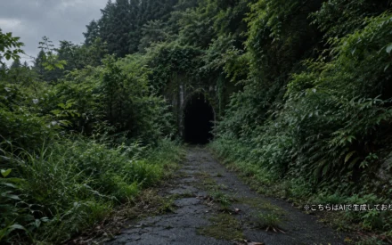
Zuzukawa Tunnel (Former Tsutsura Tunnel; Himi / Takaoka City Border)
Old-road tunnel on the Himi-Takaoka border. Rumors of a woman's suicide, flat tires and sleep paralysis lack records; listings differ on its location.